Weekend rain chances coming into better focus in Pittsburgh region
We are beginning to see model data coming into better alignment when it comes to your weekend rain chances. That's important as we are getting into peak fall foliage season.
WEATHER LINKS:
Current Conditions | School Closings & Delays | Submit Your Weather Photos
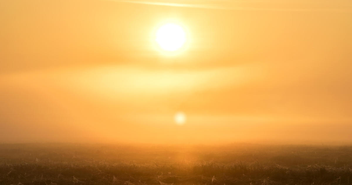
All it takes is a brief shower or two to really make the leaf colors pop.
Right now, rain chances probably aren't lining up great with weekend plans to take any sightseeing trips, with the best chance for rain coming on Sunday afternoon and lasting through Monday morning.
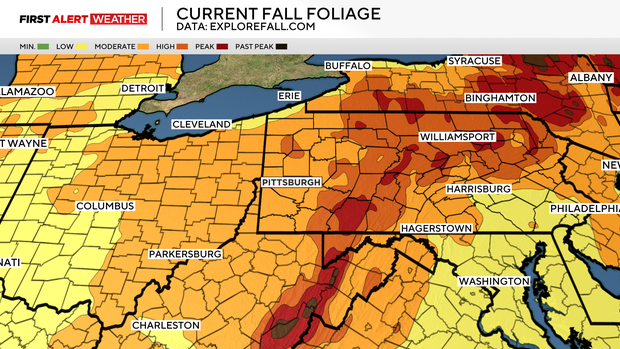
Saturday's rain chance looks highest for communities from Pittsburgh to the north. This isn't where the best leaf peaking sights can be seen, with the Laurel Highlands nearing peak color. Other places, including state parks north of Pittsburgh, are in the early stages of change. Color is still there, just not as gorgeous as what you can see in the Laurel Highlands and the Ridges at this time. This will be the last week when we will be able to say to go up for the best color.
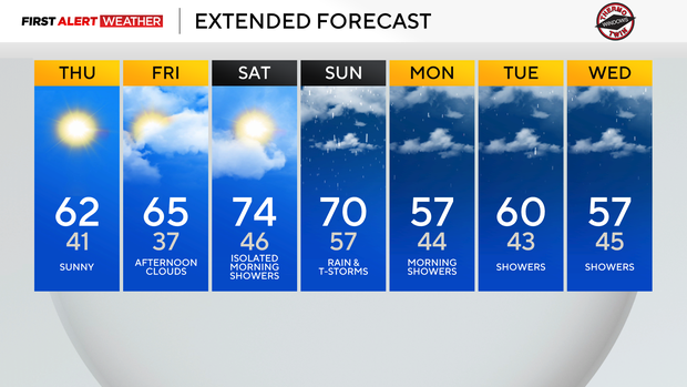
Getting back to your forecast, highs today will hit the low 60s.

Friday highs will be in the mid-60s. Friday morning temperatures should be the coolest of the week, dipping to the mid-30s in most cases. High temperatures on both Saturday and Sunday should be in the 70s. Morning temperatures both days will be well above the seasonal 'average'.
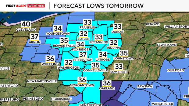
I have Sunday lows in just the upper 50s. Saturday morning lows will be in the mid to upper 40s.
Next week's weather pattern will remain active, but model data is not in agreement right now on when exactly rain will be around. I am maintaining a small scattered chance for rain Monday through Thursday.
Stay up to date with the KDKA Mobile App – which you can download here!