One more dry and sunny in Pittsburgh before an unsettled weather pattern moves in this week
Temperatures through the overnight have remained quite mild in the urban heat island of the Pittsburgh metro, while rural and outlying areas have dropped into the mid to upper 40s.
WEATHER LINKS:
Current Conditions | School Closings & Delays | Submit Your Weather Photos
Outside of a few thin cirrus clouds drifting east from Ohio and Indiana, skies are largely clear across the region. We continue to monitor a band of Canadian wildfire smoke that shows up across Lake Erie and Ontario this morning.
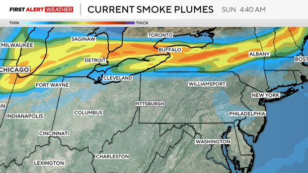
So far, there have been no reported visibility issues, and air quality has not been affected, however, skies may be a touch more hazy through the late morning and early afternoon with this coming through.
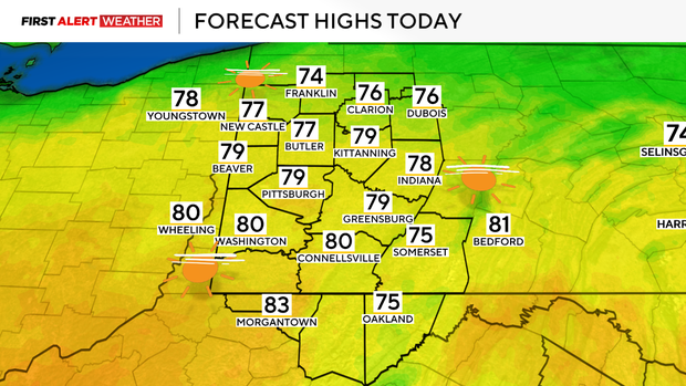
Highs will reach the mid-70s to near 80 in most locations with dry and comfortable conditions for those with any outdoor plans.
The cutoff upper-level low we've been monitoring over the Gulf Coast states over the last several days is finally starting to show signs of moving northeastward. This means an end to the clear conditions and more humid, active weather toward the early to middle portion of the week.
That system will lead to an increase in clouds Monday afternoon and evening, followed by showers after sunset Monday, Monday night, and Tuesday. Since the atmosphere will be very saturated on Tuesday, we expect quite a bit of cloud cover and slow temperature decrease with height, which should limit the instability for thunderstorms--so just rain is expected.
On Wednesday afternoon and evening, we may see a few more storms as temperatures aloft cool a bit along with the intrusion of some drier air. However, widespread severe weather is not a concern. On the backside of this system, we may see some areas of dense fog on Thursday morning due to saturated low levels and very light winds.
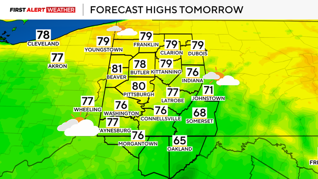
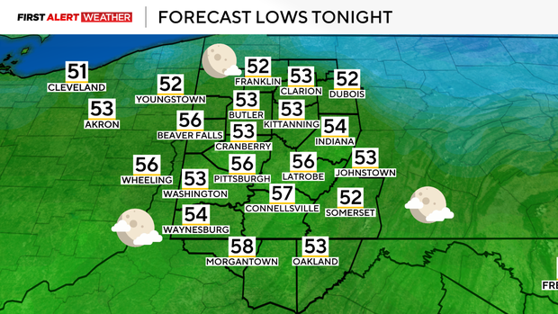
This should give way to partly cloudy skies and warmer conditions on Thursday as a short-lived ridge settles in. With the added moisture in the air along with cloud cover, the range between high and low temperatures Tuesday through Thursday won't be much. Lows near 60 with highs in the mid to upper 70s.
Our next weather system of interest will move in by this Friday. A surge of very warm, moist, and unstable air will overspread our region. This, coupled with some stronger jet stream winds aloft, will lead to stronger wind shear that could set up the potential for some severe storms Friday into Friday night, with lingering activity possible on Saturday.

There remains some uncertainty with the exact timing and location since we're still several days away, but the overall large-scale weather pattern does look favorable for some action.

Stay up to date with the KDKA Mobile App – which you can download here!