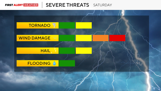
Strong afternoon storms possible in the Pittsburgh area on Saturday
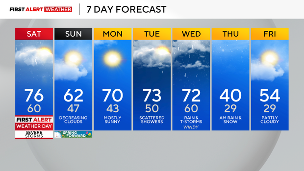
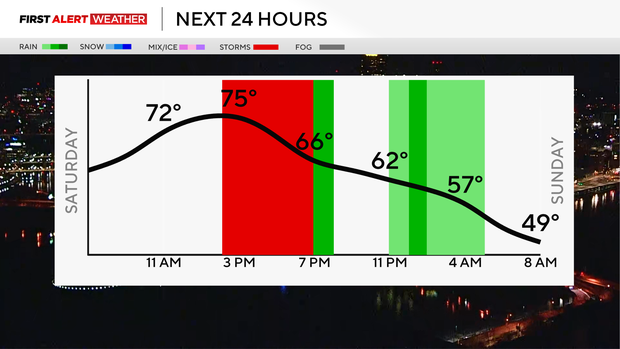
Today is a KDKA First Alert Weather Day with a line of strong to severe storms possible moving in after 2 p.m. Today could also be record-breaking with a forecasted high of 76°, which is also the record high set back in 1983.
The biggest threat today will be damaging winds and an isolated tornado, which is why we are under a 'slight risk' for severe weather, meaning isolated and is a 2 out of 5 on the severe outlook scale.
Remember when thunder roars, go indoors, especially when you are outside enjoying the gorgeous sunshine and warmth.
Hourly Temperatures:
- 9 a.m.: 67° Mostly Sunny
- Noon: 76° Mostly sunny
- 3 p.m.: 76° T-Storms
- 6 p.m.: 70° Cloudy/T-Storms
After the storms roll through, we have a few showers and storms remaining tonight and then decreasing clouds for Sunday and highs in the low 60s. Monday will also be gorgeous at 70 and sunny!
Tuesday highs stay well above normal, near 70, with scattered showers possible.
Wednesday will be our next chance for thunderstorms with highs staying in the 70s before we cool down for Thursday with the chance of a mix very early in the morning and lows back in the 20s.