Storm chances will peak by Sunday morning
Any Alert Days Ahead? Sunday will be a FAWD with strong storms possible late Saturday into Sunday morning.
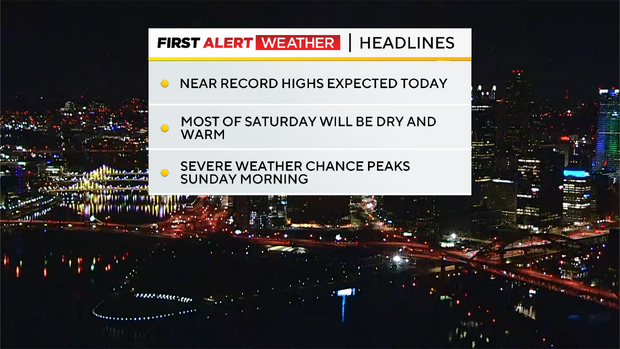
Aware: Today's record high in Pittsburgh is 78 degrees. Thursday's temperature was 18 degrees above average. So far this month we are running 6.3 degrees warmer than average.
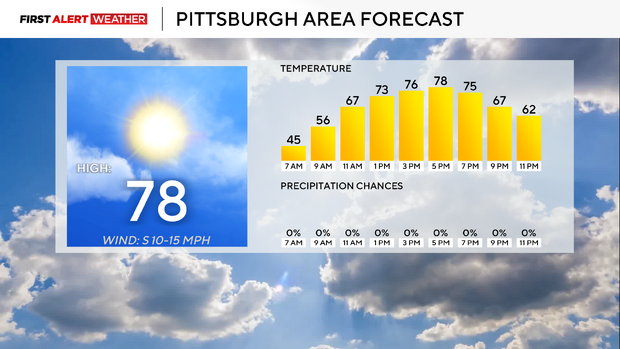
Temperatures continue to warm up. Thursday saw the warmest day yet this year, with Pittsburgh's daily high hitting 74 degrees. It'll be warmer on Friday, with record-setting highs possible. In Pittsburgh, the high today is 78 degrees. There are a couple of reasons we may not make it all the way up to 78 degrees though, including a higher moisture level at the surface (dew points in the 40s) along with partly cloudy skies moving in for the afternoon. We do have consistent winds coming out of the southeast at 10mph. For Pittsburgh, temperatures usually run warm with this setup due to sinking air coming in from over the Laurel Highlands. The dynamics in place are interesting for what normally would be an "easy" forecast day. Morning temperatures dipped to the mid to low 40s for most places Friday morning. Again, it's the warmest this week. I have noon temperatures already in the 70s.

We technically get two more well-above average days when you just look at temperatures. I have Saturday's high temperature hitting the mid-70s. Sunday highs should be near 70 degrees with highs reached well before sunrise, and temperatures slowly ticking down or holding steady for the rest of the day. There is a severe weather chance expected for the weekend. At this point the severe weather chance peaks around 3-4 Sunday morning. Strong wind speeds with a line of storms are going to be the main threat. Ahead of that on Saturday afternoon, the chance for isolated and fast-moving individual cells will also exist. These cells will require a certain level of awareness going through Saturday for people trying to get out and enjoy the warm weather. The weather can turn quickly. While strong wind is the biggest concern, as with any severe weather chance, large hail and even a tornado will be possible.
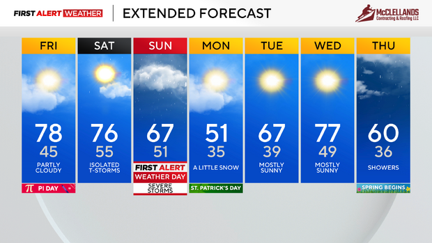
Looking to next week, it'll be cold enough for some light snow showers on Monday morning before we warm back up. I have Monday highs around 50 degrees and hit early. Tuesday highs will be in the 60s with Wednesday highs in the 70s.
WEATHER LINKS:
Current Conditions | School Closings & Delays | Submit Your Weather Photos