Scattered and light snow showers move into Pittsburgh followed by very cold air
Skies are mostly cloudy this morning with scattered areas of flurries and snow showers moving through the area this morning.
The system driving this system is lacking much in the way of moisture, which is why snowfall amounts and intensity will be very light.
WEATHER LINKS:
Current Conditions | School Closings & Delays | Submit Your Weather Photos
At best, most areas will receive a trace to under 1". The peaks of the Laurel Highlands and Ridges could see a little over 1" through noon at best.
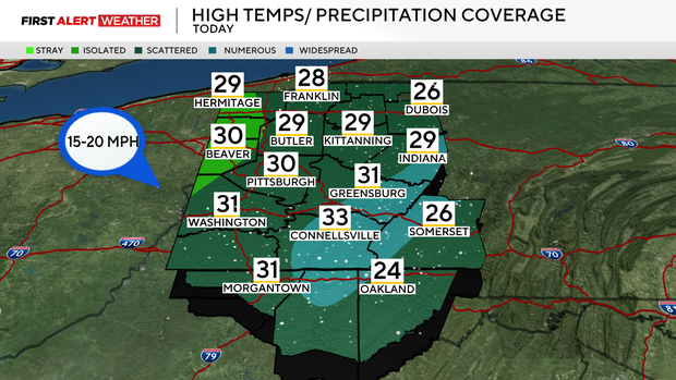
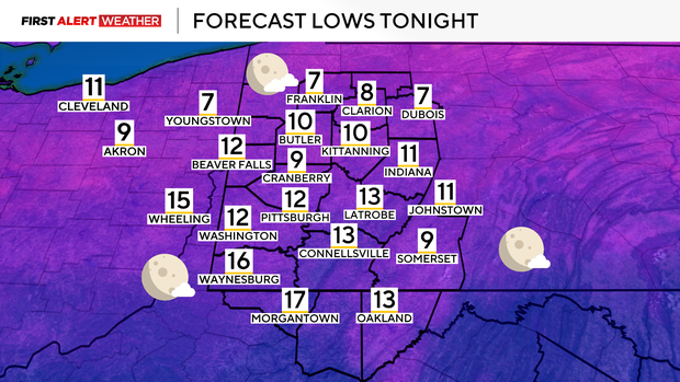
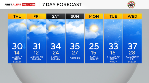
A cold front will pass through at midday with high temperatures peaking around 30 degrees midday, then steadily dropping to the mid and low 20s by late afternoon and early evening. This cold and dry air mass moving in will allow for skies to partially clear which will be of benefit to those looking for the Super Moon this evening. Overnight lows are expected to reach the lower teens with possibly a few single digits, especially along the HWY 422 and I-80 corridor.
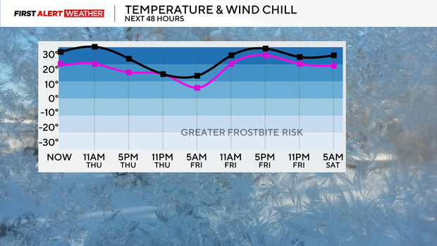
Winds will be light, so wind chills will not deviate too far from air temperatures and stay away from the threshold needed for a wind chill advisory or frostbite concerns.
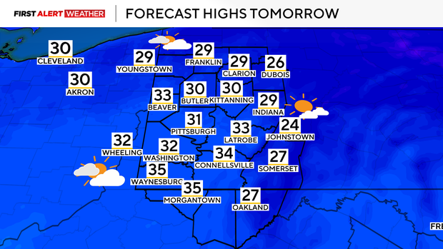
Intervals of clouds are expected on Friday and Saturday with a few weak disturbances moving through the region, but precipitation chances are expected to remain low as these systems will be weak and lacking moisture. The coldest of the air will stay to our north with highs in the low to mid 30s, which is still below normal for this time of year.
By Sunday into Monday, another cold front with a stronger cold front will move through the region with cloudy skies and a few flurries. Expect more 20s for highs and lows in the teens for the early part of next week, but there are signs that a brief reprieve from the arctic air may occur by the middle of next week as the jet stream strengthens, keeping the brutal cold air just to our north for a few days.
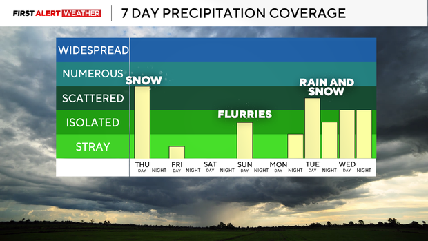
Some snow mixed with rain is possible by next Tuesday into Wednesday as a couple of stronger disturbances associated with the strengthening jet stream traverse our region.
Stay up to date with the KDKA Mobile App – which you can download here!