Severe weather will be possible tonight for parts of the Pittsburgh area
Severe weather will be possible Tuesday evening throughout parts of the Pittsburgh area.
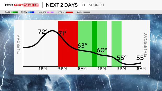
FIRST ALERT: This evening with strong to severe storms possible between 7 p.m. and 2 a.m.
AWARE: Mild this week then showers and cooler temperatures for Easter Sunday
As we wrap up the month of March, we are nearly 7 degrees above normal and picked a little over 6" of precipitation which is also above normal. We could add a little more onto that late tonight with a line of storms moving in.
The chance of rain sticks around all week long, but we have some days where we could get close or touch 80 degrees. There will be dry time to enjoy those warmer temperatures this week but keep the rain gear close by.
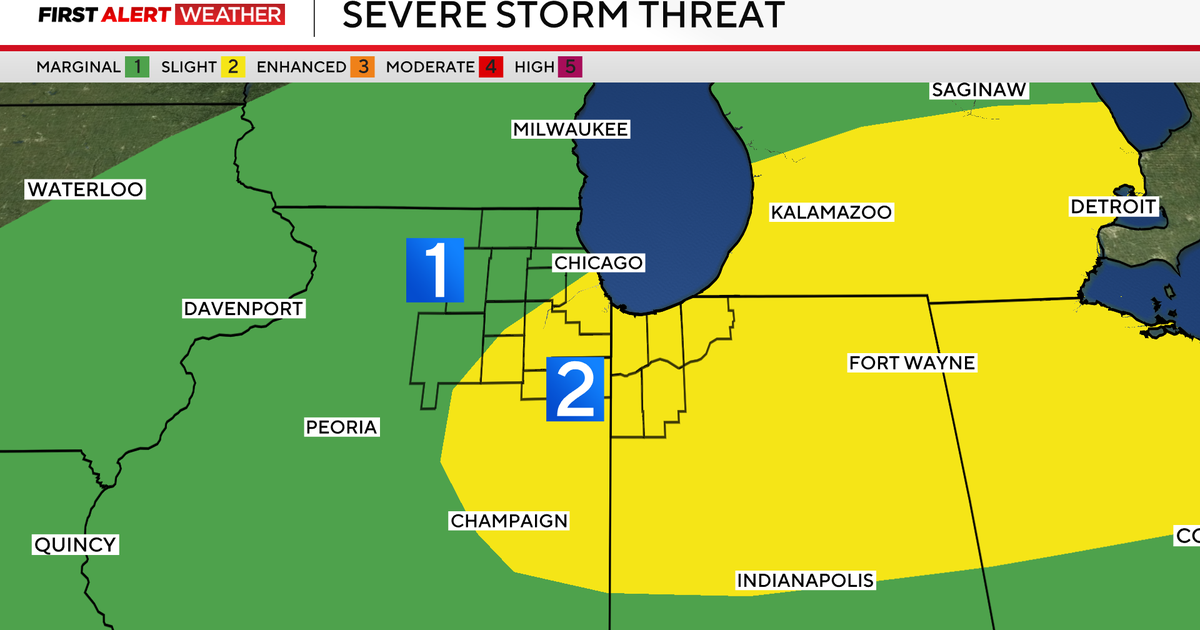
Today we are under a 'slight risk' for severe weather for areas in Pittsburgh and north meaning scattered strong to severe storms are possible with damaging winds, hail and an isolated tornado not out of the question. This also means confidence is higher that storms will develop on a scale of 2 out of 5.
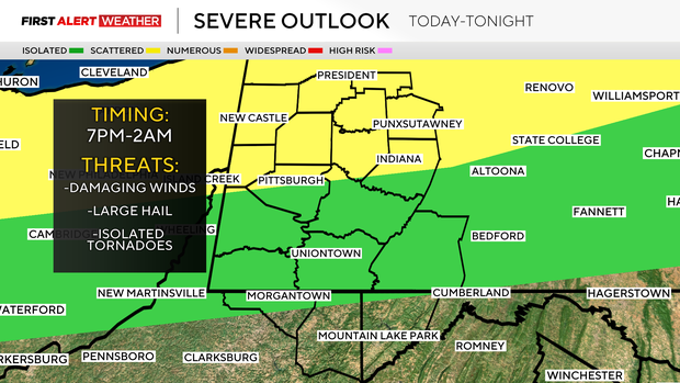
Storms will weaken as the move in but make sure you have a plan in place and devices charged because overnight a lot of people will be asleep and possibly woken up by these storms.
Saturday looks to be the driest day this week with a low chance of rain but rain chances increase on Easter Sunday in the morning, and daytime temperatures sit in the mid to upper 50s as of right now.