Severe storms possible throughout Pittsburgh region late Sunday night into Monday | First Alert Weather
A powerful storm system is plowing through the Midwest this evening, bringing severe storms to Ohio, Indiana, and areas south and west.
Daily average High: 55° Low: 35° | Sunrise: 7:06 a.m. Sunset: 7:43 p.m.
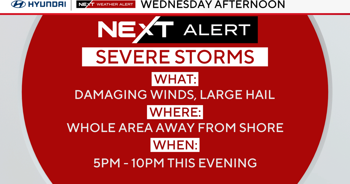
FIRST ALERT: Storms later tonight through Monday morning. Damaging winds are possible (midnight through 4 a.m.) and tornado risk.
AWARE: Soggy starting Wednesday

That line will move toward our region through the late evening and, if it holds together, could bring us a quick-moving shot of strong to severe storms right around midnight.
The main threat with this system will be storms with damaging winds and a tornado risk. Hail is also possible. The timeline will be mainly between 9 p.m. and 4 a.m., with the gustiest winds possible around midnight to 2 a.m.
Another line of storms is possible Monday until noon, but how much this first line holds together will determine how strong the second line is. The environment may be set up to allow the storms to weaken before they reach southwestern Pennsylvania, but you should have a way to get weather warnings tonight before you go to sleep, including enabling weather warning notifications on your mobile phone or having a NOAA weather radio to alert you if a tornado warning is issued and you need to take cover.
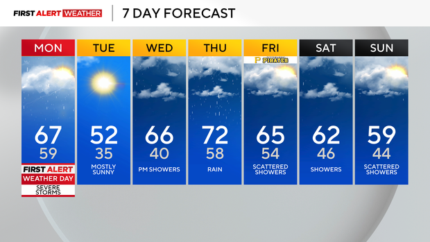
After the storms on Monday, things calm down after noon and temperatures are in the upper 60s and calm throughout the second part of the day.
Tuesday will be the coolest day of the week with highs back near 50, but it'll be mostly sunny. Rain returns later Wednesday, and we're in for a soggy end to the week, and will have to watch for potential flooding concerns.
WEATHER LINKS:
Current Conditions | School Closings & Delays | Submit Your Weather Photos