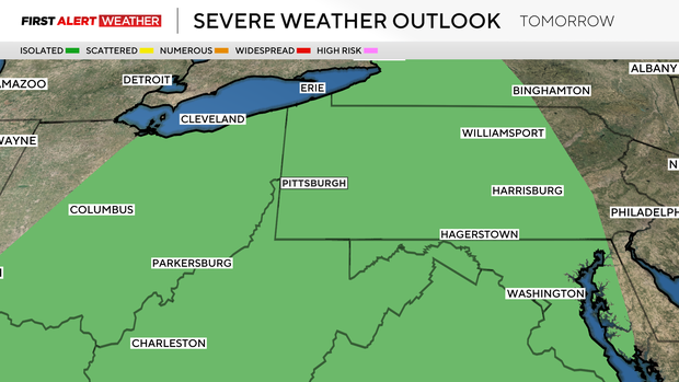
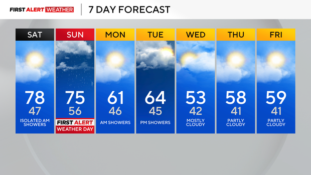
Saturday will be a beautiful fall day before severe weather potentially moves into the Pittsburgh area

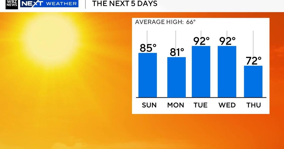
We have a gorgeous, mild Saturday ahead with highs well above normal in the mid to upper 70s. Today will also be dry, so get out and enjoy it before rain arrives tomorrow.
WEATHER LINKS:
Current Conditions | School Closings & Delays | Submit Your Weather Photos
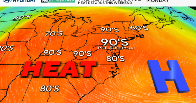
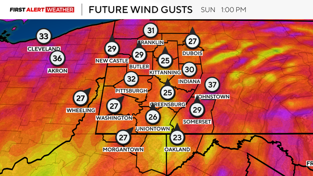
Sunday is a First Alert Weather Day with highs again in the mid to upper 70s.
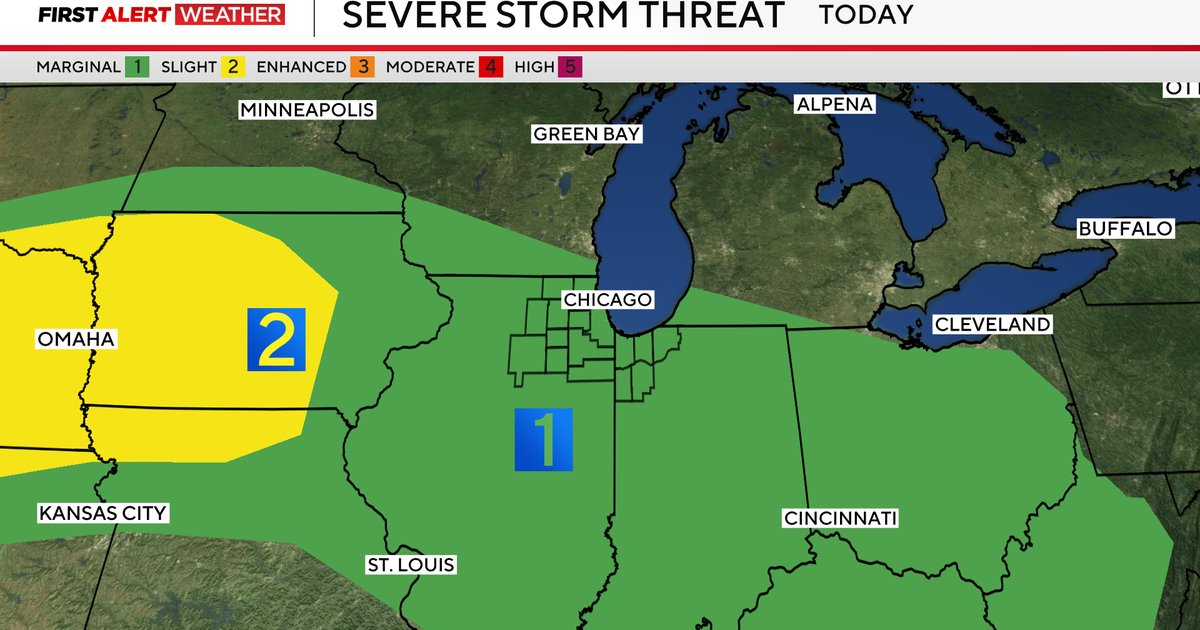
It'll also be windy, so make sure you secure those loose outdoor Halloween decorations and cover up anything that you don't want to get wet. There will be scattered showers and possible thunderstorms starting around 1-2 p.m. tomorrow. There's a marginal risk for severe weather across the region (1 out of 5) for isolated strong to severe storms.
We have a squall line moving through shortly after that into the evening, which will be the cold front that brings gusty winds of about 30-40mph to the area. With the warm, humid air and increasing wind shear, this provides enough instability for a few storms to form, where an isolated tornado also can't be ruled out.
Most locations will just see rain with .50-1" estimated totals. The rain will be beneficial to our drought situation, but we still need over 1" to catch up to our deficit for the month.
Monday, we will have a few early showers, and high temperatures will be back to normal in the low 60s. A few showers are possible Tuesday and then the chill takes over for the rest of the week with highs in the low 50s Tuesday and mid to upper 50s through Friday.
Stay up to date with the KDKA Mobile App – which you can download here!