After nearly a full week of rain in the Pittsburgh area, a mostly dry weekend looms
Our 4-day rain total is 2.8". We are now 0.36" of rain ahead of the monthly average. It appears we will finish the month slightly shy of the monthly 'average'.
For the year, we are -1.98".
WEATHER LINKS:
Current Conditions | School Closings & Delays | Submit Your Weather Photos
Monday to Thursday rain totals sit at 2.8". This is pretty close to the average rain received in most areas over the same time period. Some areas saw well over that, though. For the month, we are slightly ahead of the 'average' pace, but will more than likely finish the month around half an inch shy of the monthly average.
For the year, we are currently -1.98".
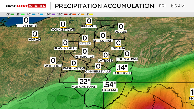
Looking at our rain forecast over the next week, it looks like the Pittsburgh area will see little in the way of precipitation.
As of 4 a.m., a currently unnamed disturbance sitting off the Dominican Republic coast has a 90 percent chance for development over the next week. Most data shows this system impacting the East Coast and maybe even bringing a chance of rain as far inland as Pittsburgh.
Right now, it looks like late Monday night into Tuesday morning would be the impact time for us, but things are going to change with the system depending on overall strength and when it intensifies.
Just know that we are watching it.
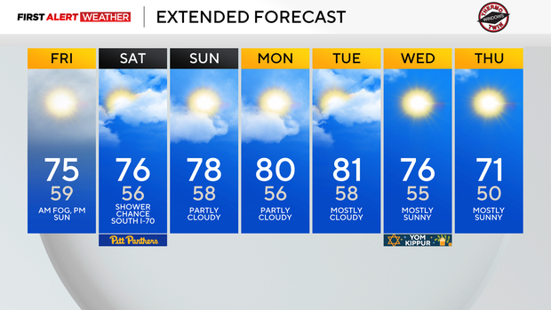
Besides that, the next week looks dry and unseasonably warm.
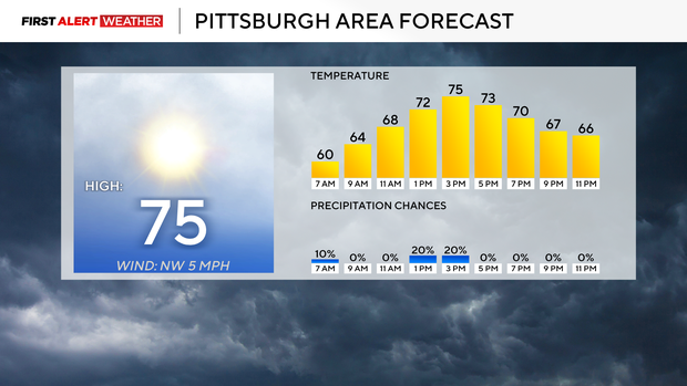
I have highs today, hitting the mid-70s. We should also be in the mid-70s for highs on Saturday before temperatures start to tick up. Sunday's highs will be near 80 degrees, and we should remain up there near or in the 80s for highs on both Monday and Tuesday.
Highs will then dip back to the 70s starting on Wednesday. During this stretch, most mornings will look similar as they should be comfy with temperatures in the 50s. For Pittsburgh, it looks like our next rain chance will be next Saturday.
Stay up to date with the KDKA Mobile App – which you can download here!