Pittsburgh Weather: Precipitation And Cooler Temperatures Expected Wednesday Morning
PITTSBURGH (KDKA) - A mid-level gulf low is tracking northeast through our area today.
Right Now: Light to moderate rain with temperatures hovering around 32 for most this morning. Some places in the Laurels (Somerset) will see periods of moderate to heavy snow with accumulations more than an inch possible with trace ice amounts.
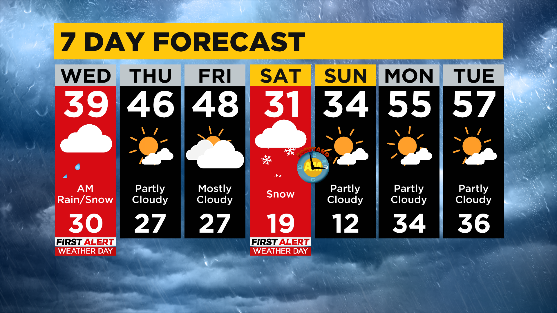
Alert: Today is one of two alert days over the next 7 days. The second one is Saturday where 2-4" of snow is expected to fall region-wide. Snow WILL have an impact on the St Patrick's Day Parade.
Aware: Nice warm-up occurs as we head into the next work week with high temperatures back near 60.
Generally, with this type of track and where the low has come from you'd expect a moisture-rich environment with rainy conditions. The issue is this warm burst of air will be moving into a much colder environment, meaning that the initial push of moisture into our region will see the possibility of snow and or sleet.
WATCH: Lindsay Ward Reporting Live From The Mobile Weather Lab
WEATHER LINKS:
Current Conditions | School Delays & Closings | Local Radar | Weather App | Photos
The impact to area drivers will be minimal unless traveling through some of our more elevated areas like Somerset and Cambria County.
There is a Winter Weather Advisory for higher elevations through this afternoon.
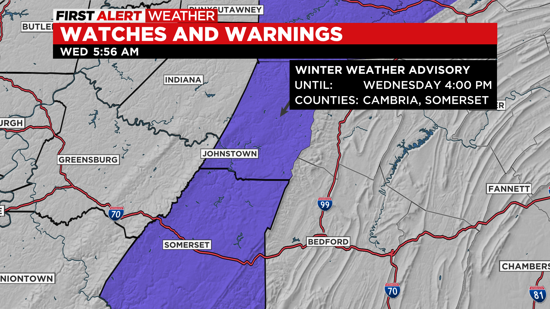
The track of the low will bring the largest precipitation chance to this area. This also happens to be where conditions will be primed for snow accumulation due to the ground being higher and in a colder environment. While snow totals by themselves would normally not be enough for a Winter Weather Advisory, the small ice chance on top of the 1-2" of snow that will be possible does meet the criteria for an advisory and the NWS has issued an advisory for this area through 4 p.m.
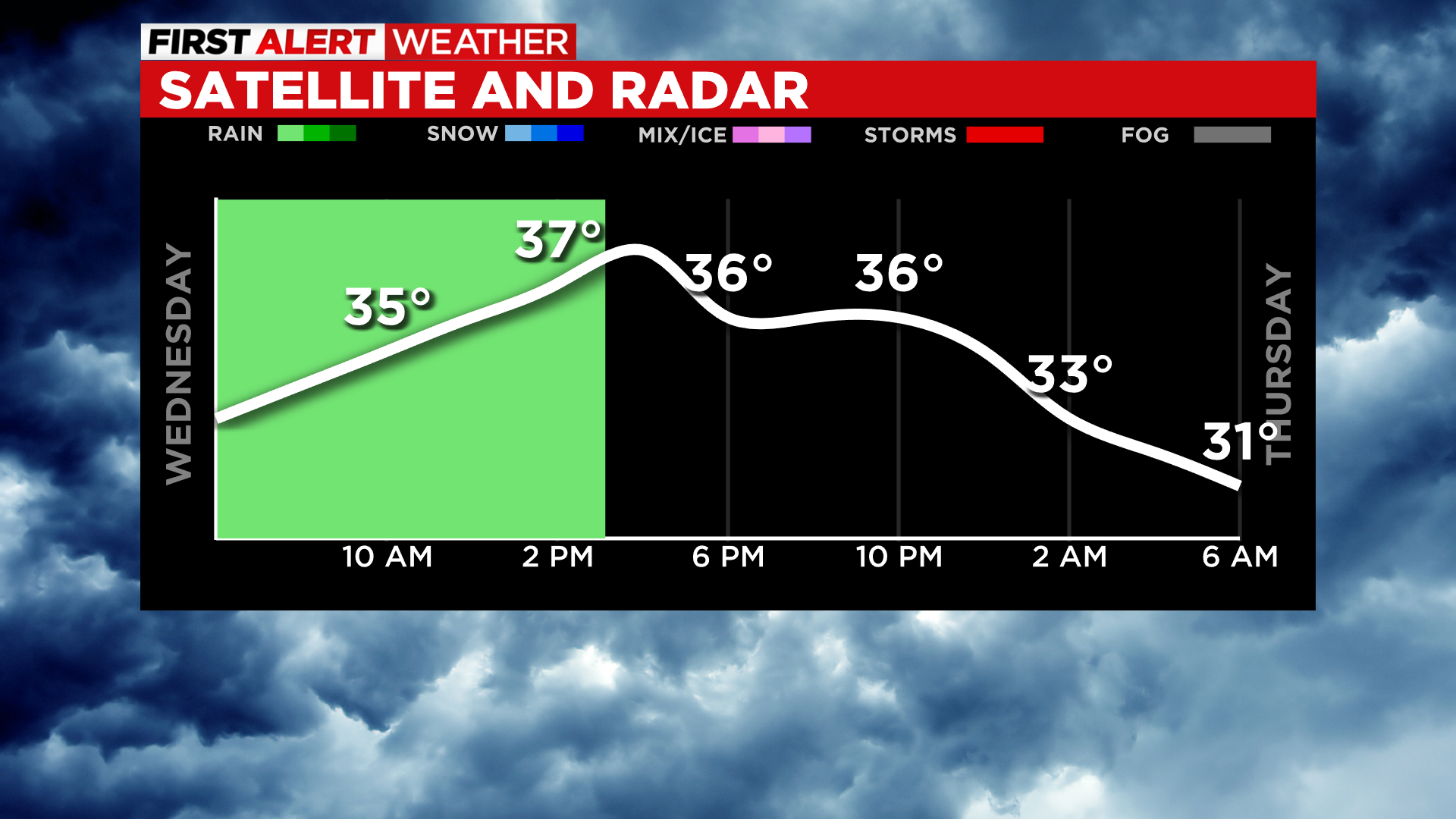
For those not in the Laurels today, high temperatures should get back to around 40 degrees this afternoon after we cotton out this morning in the low 30s. Skies will be cloudy and the best chance for a cold rain occurs during the morning hours through around 2 this afternoon. Winds will be out of the northwest at around 10mph this afternoon with gusts around 20 mph.
Overnight temperatures will dip close to the seasonal average for this time of the year (28°).
Looking ahead, Thursday is looking completely dry with highs rebounding and hitting the mid-40s. Friday, for all intents and purposes, will also be dry with just a slim chance for rain arriving just before midnight. Friday highs will be near 50 degrees.
That brings us to Saturday where most places at this time should expect between 2-4" of snow to fall during the morning hours. Yes, winter isn't done with us just yet. Most of Saturday's snow falls during the late morning hours. The St Patrick's Day parade begins at 10 a.m.
There may already be two to three inches of snow on the ground by the time the parade kicks off with more coming down during the parade. While Saturday's high will be near 32 degrees, parade time temperatures will only be in the 20s and falling.
Stay up to date with the KDKA app, which you can download here.