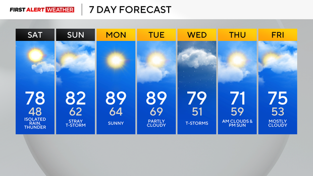
Pittsburgh's temperatures climb into the high 70s on Saturday, severe weather possible

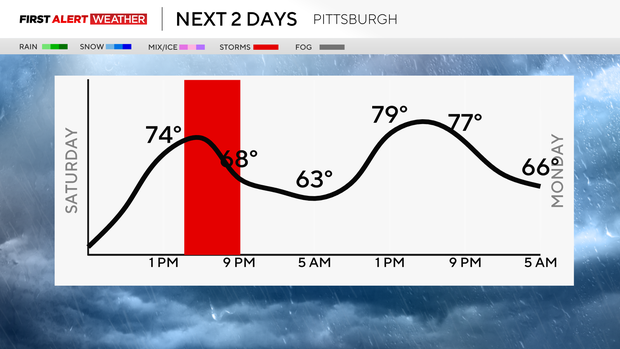
A gorgeous sunny start to our Saturday, then the chance of showers increases this afternoon. Highs will stay in the mid 70s due to increasing clouds this afternoon.
The severe weather threat stays east with a "marginal risk" in those areas (1 out of 5), which means a low confidence for isolated strong to severe storms to develop.
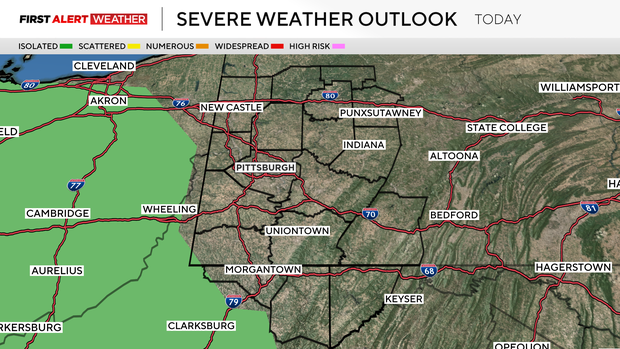
They will weaken as they cross the West Virginia panhandle, so for us around the Pittsburgh region, much of the day will be dry, but a rumble of thunder can't be ruled out around 4/5 p.m.
Hourly Forecast:
- 9 a.m.: 59° Mostly Sunny
- Noon: 74° Mostly Sunny
- 3 p.m.: 76° Partly Cloudy
- 6 p.m.: 77° Possible T-Storm
Winds will pick up around 20 mph this afternoon.
Tomorrow we are partly cloudy with highs in the low 80s before sunny skies return to kick off the work week.
Record high temperatures are possible on Monday. We are forecasting a high of 89° both Monday and Tuesday, but if we hit 90° on Monday, we will most likely hit it on Tuesday.
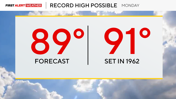
The record Monday is 91° back in 1962, and Tuesday's record is 93° back in 1877!
Wednesday will be our next chance of showers and thunderstorms with highs near 80 before we cool down near normal Thursday with partly cloudy skies and highs back in the low 70s.