Pittsburgh Weather: Warmer weather rolls into the Pittsburgh area, causing morning fog and rain
PITTSBURGH (KDKA) - If you listen closely right now you may be able to hear the ongoing melt.
Temperatures have returned to well above normal today with morning lows dropping to nearly 40 degrees. That's a good ten degrees above yesterday morning's lows and 30 degrees warmer than Monday's low of 9°.
WEATHER LINKS:
Current Conditions | School Closings & Delays | Submit Your Weather Photos
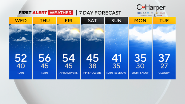
Highs today will hit the low 50s, with noon temperatures near 50°. The warmth will remain in place through Thursday (High of 56°) before we see temperatures going the other way.
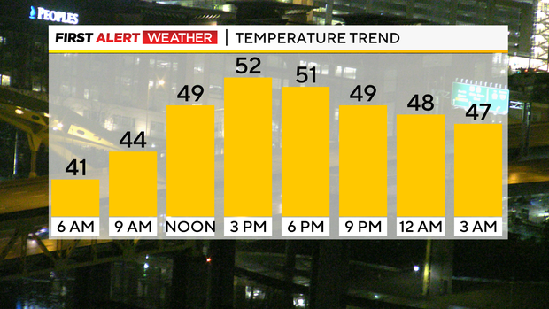
By the weekend highs will be back down in the 40s…
The surge of warmth is also pushing up dew points, causing visibility issues for the morning. There are dense fog advisories posted through 11 this morning for places north of Pittsburgh.
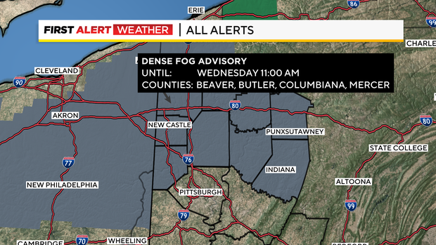
A quick look at visibilities shows a band from the turnpike in northern Allegheny County to I-80 with visibilities that have dipped to ~0.
The fog is thick.
The other issue for today is light to moderate rain and I expect to return before the end of the morning commute.
Rain totals in most places should be more than a quarter of an inch but less than a half inch.
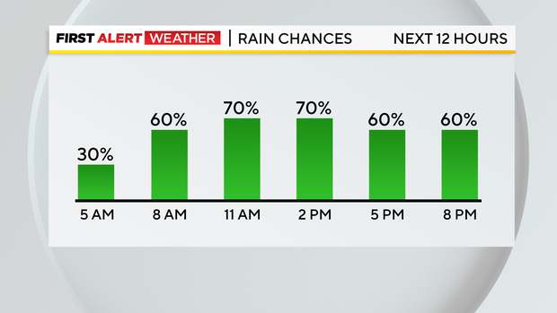
The heaviest rain should push through around or just after noon with a steadier rain sticking around through the evening commute. We should briefly get a break from the rain on Thursday morning before another round slides through Thursday night into Friday morning.
Finally, a final round of rain is expected on Saturday into Sunday with a change over to snow showers late Sunday into Monday.
Stay up to date with the KDKA Mobile App – which you can download here!