Afternoon snow flurries possible as cold temperatures remain in the Pittsburgh region
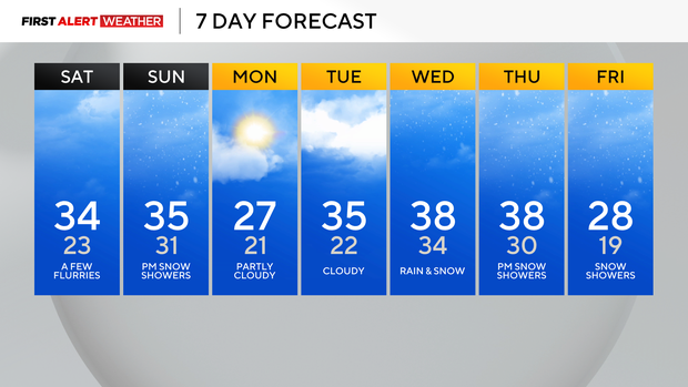
This weekend, our highs stay hovering around the freezing mark with cloudy skies and some occasional flakes.
WEATHER LINKS:
Current Conditions | School Closings & Delays | Submit Your Weather Photos
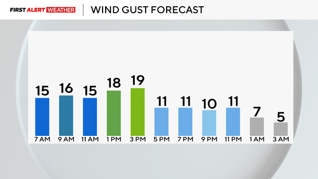
With wind gusts around 20 mph at times, it'll feel in the 20s for most of the day. A few snow showers will arrive Sunday afternoon and possibly even mix in the evening.
Little to no accumulation is expected.
Hourly Conditions
- 9 a.m.: 29° Cloudy
- Noon: 32° Cloudy
- 3 p.m.: 33° Mostly Cloudy, Flurries
- 6 p.m.: 32° Cloudy
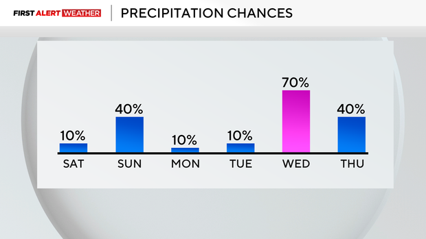
Our next chance of snow showers will be on Tuesday.
Wednesday will be the warmest day of the week with highs back near 40, which is closer to average, and a wintry mix is possible. Temperatures will fall throughout the day on Thursday, and snow showers are also possible in the afternoon and evening.
Our temperatures are still trending below normal throughout mid-December, and we are already over 9° below normal for the month so far!
Stay up to date with the KDKA Mobile App – which you can download here!