Pittsburgh Weather: Partly sunny skies conclude the weekend, but snow looms this week

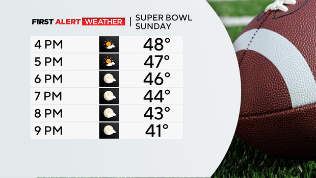
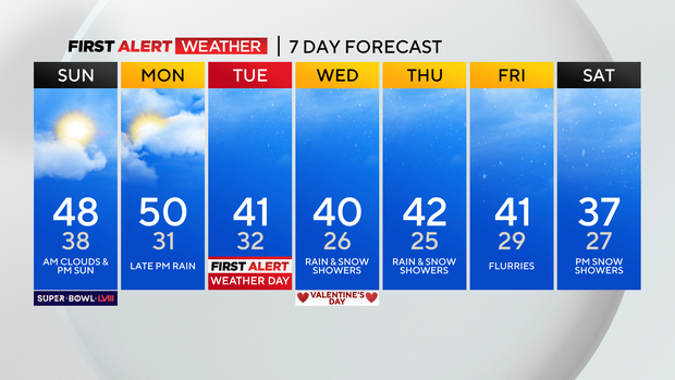
PITTSBURGH (KDKA) - Today is Super Bowl Sunday and it'll become partly sunny after a few sprinkles south with highs near 50.
Rain and snow for some returns Monday with highs staying above normal near 50 and then switching to a wintry mix overnight into Tuesday.
WEATHER LINKS:
Current Conditions | School Closings & Delays | Submit Your Weather Photos
Tuesday is a First Alert Weather Day with the most snow accumulation for areas in the ridges and Laurel Highlands.
There is a Winter Storm Watch for those areas including Somerset Co. starting at 6:00 p.m. Monday and going until 1:00 p.m. Tuesday.
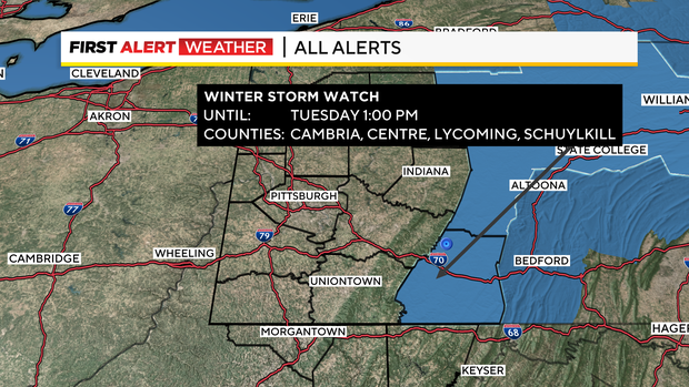
Those areas could pick up 2-4" and even 6" for the higher elevations.
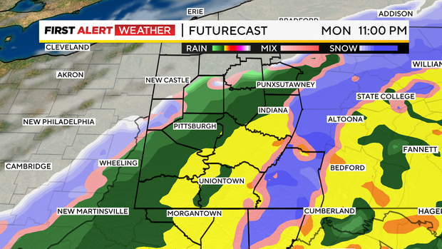
This system will come in from the southwest bringing (right now) mostly rain for Pittsburgh which will be heavy at times right around dinner time Monday evening.
Around midnight we will see a wintry mix for areas northwest of Pittsburgh and in the Laurel Highlands then to all snow until about 4:00-5:00 a.m. on Tuesday.
A few scattered snow showers linger on Tuesday, but highs will be around 40°.
Lows are back below freezing through the week and Wednesday through Thursday rain and snow showers are possible with highs near 40.
More snow showers are possible on Saturday evening with seasonable highs in the upper 30s.
Winter isn't done with us just yet!
Stay up to date with the KDKA Mobile App – which you can download here!