Pittsburgh Weather: Icy Spots And Refreezing Still Pose A Risk
PITTSBURGH (KDKA) -- We are waking up to temperatures colder than yesterday in the single digits with some areas dealing with sub-zero wind chills.
We have clear skies this morning and a lot of the roads are much more clear than yesterday, but there will still be icy spots on any untreated surfaces -- especially mailboxes and even bushes and trees.
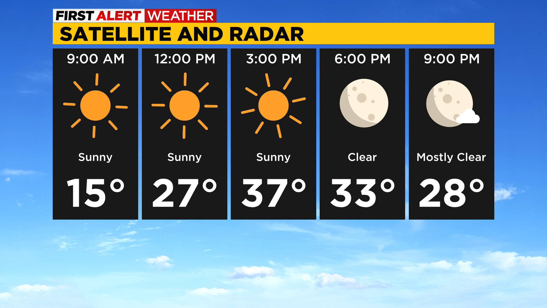
We will finally get some melting today with sunny skies and highs back near normal in the upper 30s.
Overnight lows drop to the low 20s which is where we should be this time of year, but there could be a refreeze with the melting occurring so watch for slick spots at the bus stop.
Tomorrow will be very similar where it looks even warmer getting to the 40s before we drop back down to the upper 20s on Tuesday.
There may very well be a few flurries flying around through the week but no accumulation is expected.
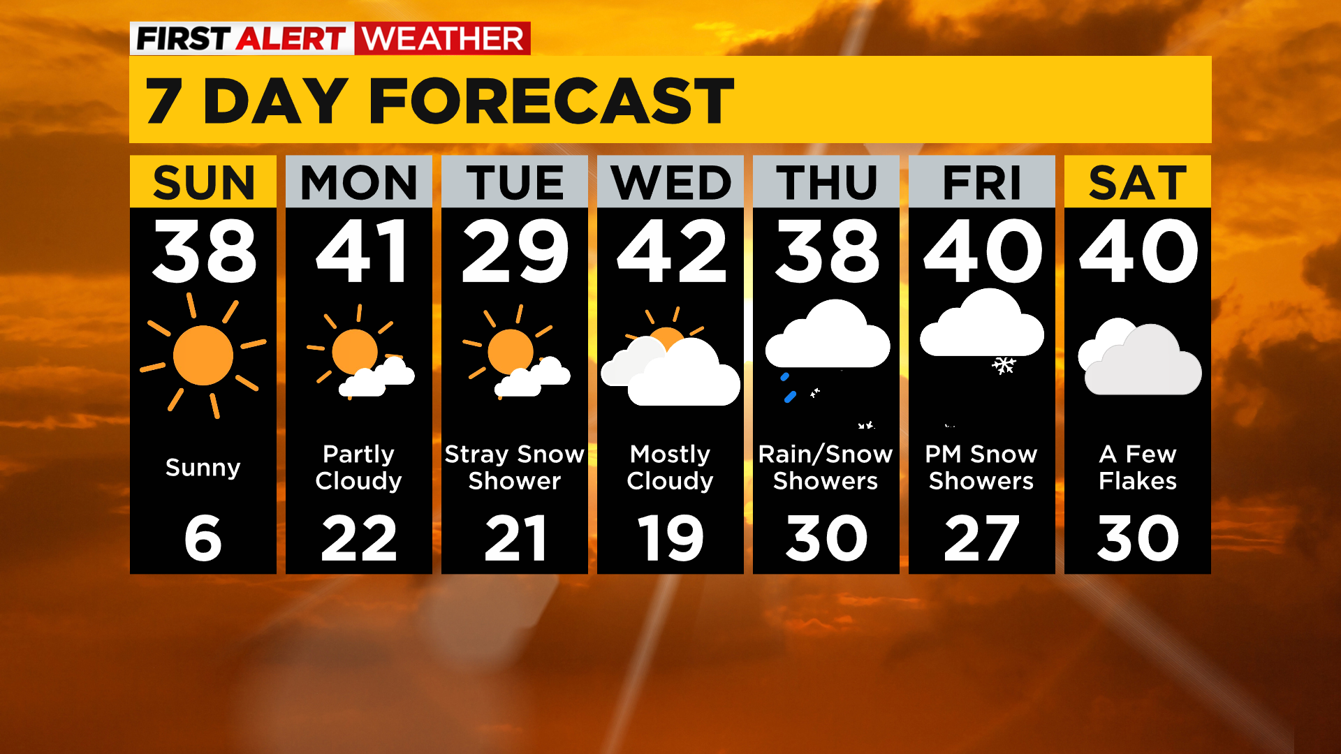
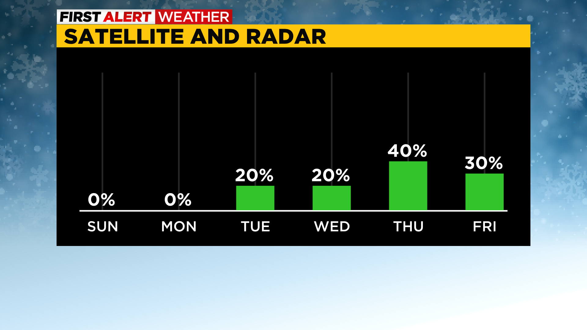
Our next chance for light snow accumulations will be Thursday as a weak trough moves through the region bringing the potential for rain/snow showers.
WEATHER LINKS:
Current Conditions | School Delays & Closings | Local Radar | Weather App | Photos