Pittsburgh Weather: Warmup On The Way After Bitter Blast
PITTSBURGH (KDKA) -- After a very cold start on Sunday morning, Pittsburgh's official low was 1 degree, we are on the path to a nice warmup for the first half of this week and the start of February.
WEATHER LINKS:
Current Conditions | School Delays & Closings | Local Radar | Weather App | Photos
January is ending as the snowiest in a decade with 19.2 inches of snow in Pittsburgh. We'll see a few snow showers continue through Sunday evening, especially in the Laurel Highlands, amounting to little more than a dusting in spots and up to an inch at most in higher elevations.
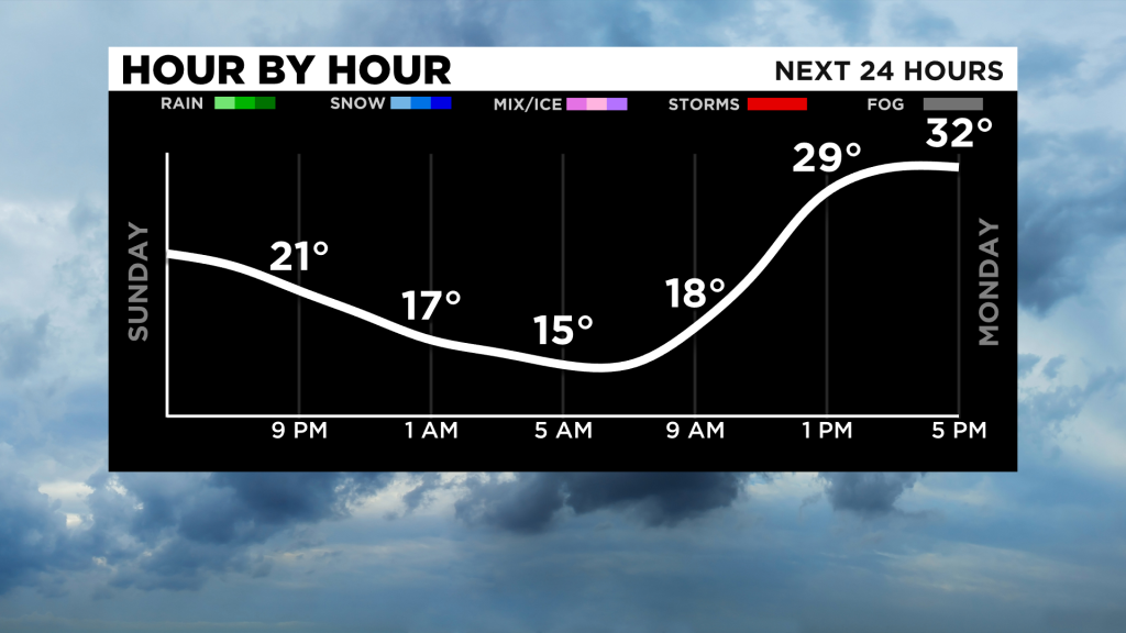
Monday will be drier and not as cold, with lows Sunday night in the teens and highs Monday reaching the lower to mid-30s. We're on our way to the 40s for mid-week with some rain/snow possible later Wednesday.
This system bears watching as it could bring potentially heavy rain, which could prompt some flooding concerns with snowmelt and runoff, and some snow/freezing rain/wintry mix as temperatures cool back down on Thursday.
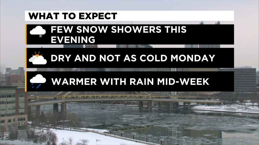
The path, amounts and precipitation type are uncertain right now, but we'll be watching the models and how this unfolds to start the week and will alert everyone of any potential disruptive weather.