Pittsburgh Weather: Cold Snap Grips Area Before Weekend Warmup
Follow KDKA-TV: Facebook | Twitter
PITTSBURGH (KDKA) – After the Sunday snowstorm dumped snow on the majority of the KDKA viewing area, a cold snap will grip the area for the next couple of days.
Current Conditions | School Delays & Closings | Local Radar | Weather App | Photos
Cold air will continue to drain into the area overnight Monday, with single-digit temperatures and light winds. Wind chill values will dip below zero in many areas early Tuesday.
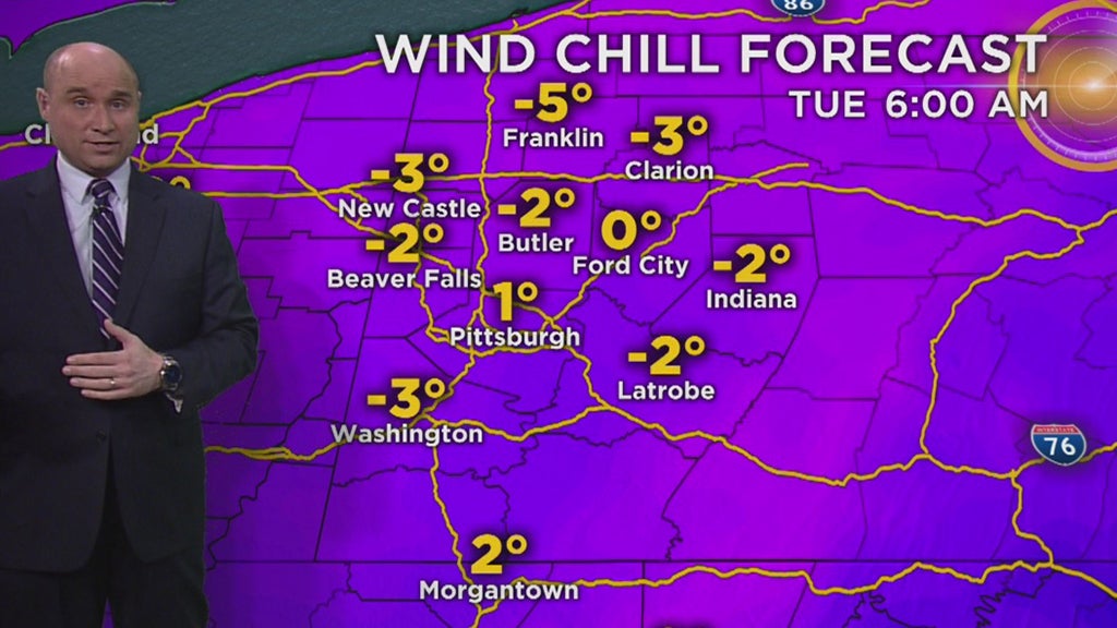
The cold and breezy conditions will continue through Tuesday, making for a wind chilly day.
Late Tuesday, snow showers will scatter around the area.
Accumulations are expected to be rather light in most cases, with an inch possible in those lake effect prone areas along I-80 and in the Ridges.
It is not all wintry weather in the forecast, though. A significant warmup is expected by the weekend.
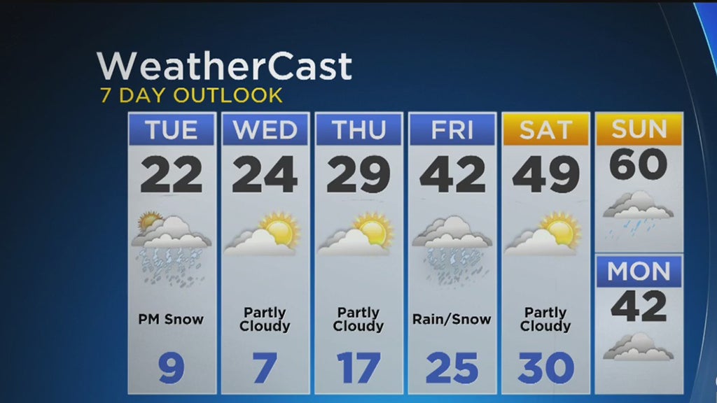
Highs by Sunday may even flirt with the 60s.
Stay up to date with the KDKA app, which you can download here.


