Pittsburgh Weather: Cold Day Ahead With Near Single-Digit Wind Chills
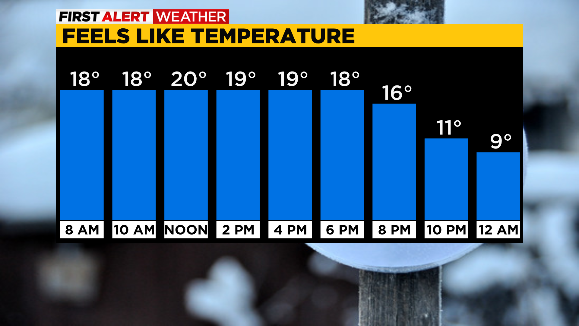
PITTSBURGH (KDKA) -- It's a cold morning with lows below normal in the teens and near single-digit wind chills.
Alert: None
Aware: Quick burst of snow showers possible south of I-80 this evening with up to 1" possible. Colder weather sticks around through Tuesday morning.
There will be plenty of sunshine this afternoon, but it'll be deceiving with highs only in the upper 20s.
Watch for icy spots!
There's a few flakes that will be flying around today with the colder air in place and winds from the north but little to no snow accumulation is possible.
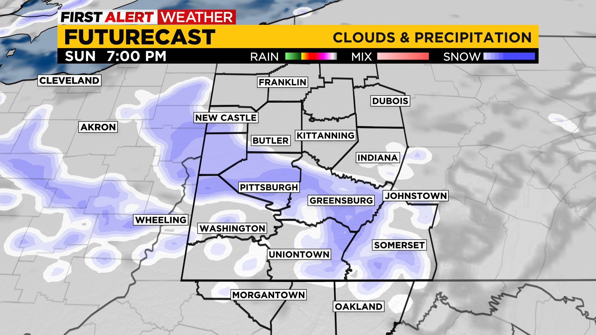
Late tonight a quick snow possible around dinner time and wrapping up early Monday morning before sunrise.
Moisture is limited with this upper trough, but some could pick up about 1" or less!
Valentine's day will be a cold one with highs staying in the upper 20s with dry conditions and sunshine.
Monday morning at the bus stop will be the coldest with some areas dipping to the single digits.
Seasonable temperatures return Tuesday with highs near 40 and continuing sunshine.
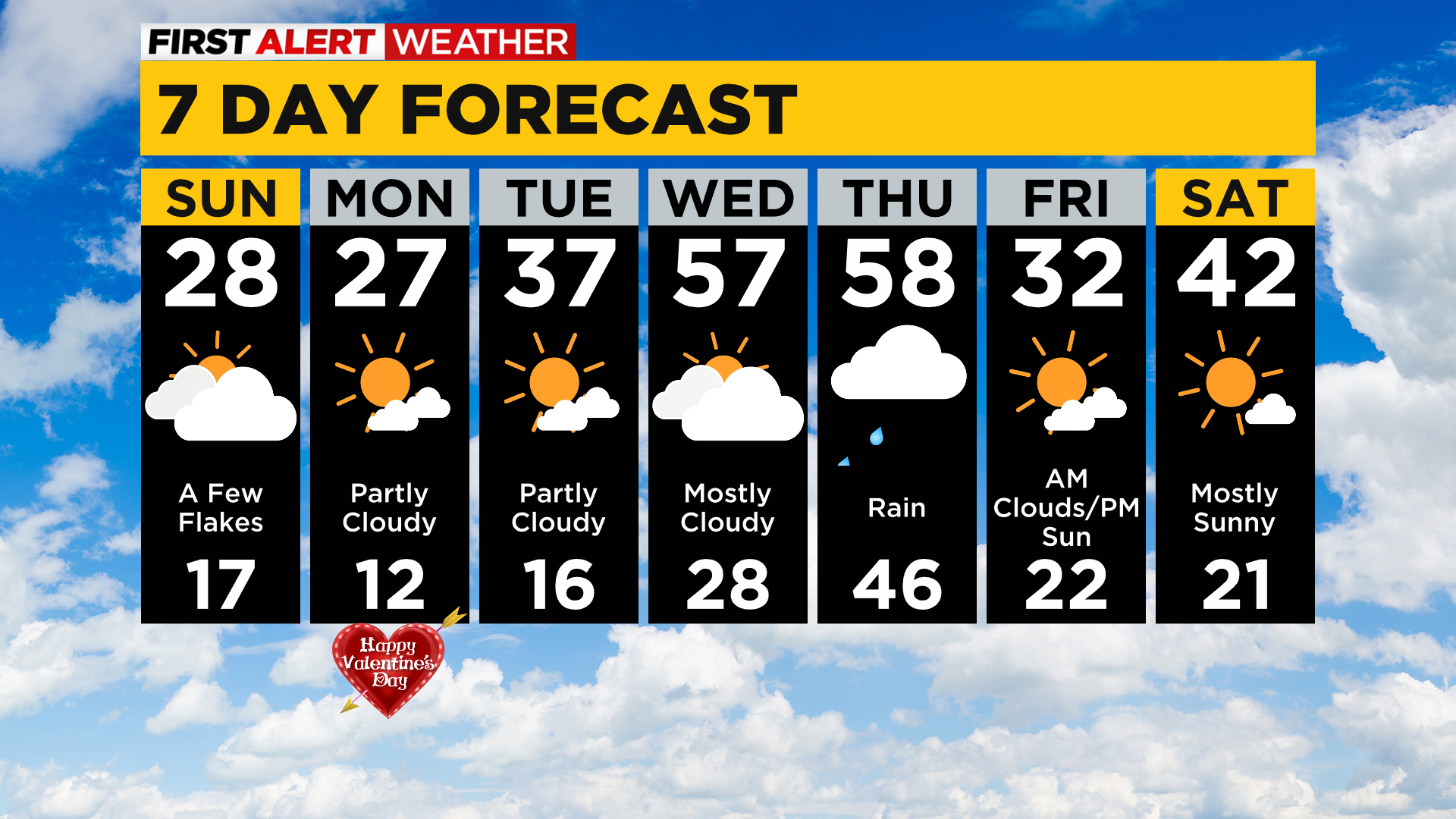
The pick of the week is Wednesday with highs back in the mid 50s with partly cloudy skies and then at or near 60 Thursday with rain showers returning.
WEATHER LINKS:
Current Conditions | School Delays & Closings | Local Radar | Weather App | Photos