Pittsburgh Weather: A cold and snowy weekend ahead
PITTSBURGH (KDKA) - It's going to be a chilly weekend!
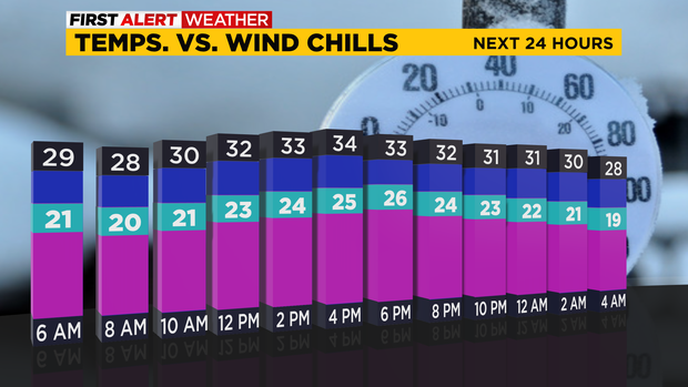
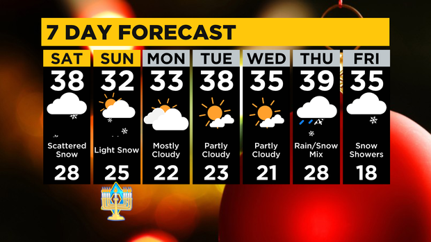
Highs are only in the low to mid-30s. There are a few light snow showers possible today that could drop a dusting on surfaces. Some snow showers could pick up in intensity Saturday night, so a quick inch is possible, especially in the higher elevations.
WEATHER LINKS:
Current Conditions | School Closings & Delays | Submit Your Weather Photos
Snow showers will be tapering off come Sunday. A few inches in total through Sunday are possible for the ridges/laurels and less than an inch for lower elevations.
Next week, the sun tries to come out on Monday, but skies will be partly cloudy on Tuesday and Wednesday.
It'll still remain on the cold side with highs only in the mid to upper 30s and morning lows in the 20s.
There is a major system expected to impact holiday travel starting mid-week.
Come Thursday, a rain/snow mix will start it off then eventually switch over into all snow by Friday. Still too early to call for snow totals. Travel could get pretty messy those two days, so stay weather aware! The forecast could always change.
Christmas weekend is looking very cold and well below average. Christmas Eve will likely have 20s for highs, and Christmas Day will probably be in the teens.
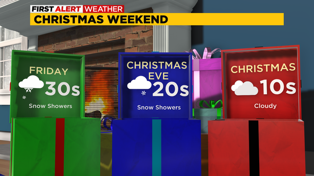
Morning lows could be in the teens or single digits.
So bundle up for this year's holiday and drink all the hot chocolate!❄️
Stay up to date with the KDKA Mobile App – which you can download here!