Severe weather chances return to the Pittsburgh-area forecast on Tuesday

Severe weather chances will return to the forecast for the Pittsburgh area on Tuesday.
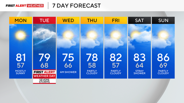
Today will be gorgeous with low humidity and highs near normal, in the low 80s with mostly sunny skies.
Tomorrow is our next First Alert Weather Day as strong to severe storms are possible along a cold front.
We are under an Enhanced Risk for severe weather which means a higher confidence for more numerous storms to be severe. It's a 3 out of 5 on the severe weather scale.
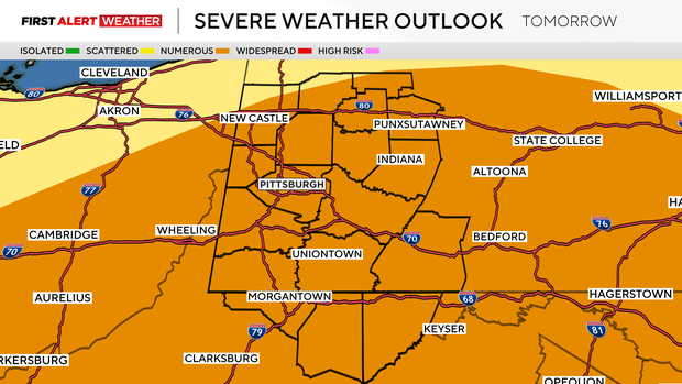
Damaging winds, flash flooding, small hail, and even possible tornadoes arrive after noon north and move through Pittsburgh and south into the evening.
Most of the storms will be before 5 p.m. Stay weather aware!
After storms move out, it'll be nice for the remainder of the week.
A few showers linger Wednesday, but those below normal temperatures will stick around with low humidity for the remainder of the week!
For the month so far, we are a little over 5 degrees above normal for temperatures and nearly 1.30" above normal for precipitation.


