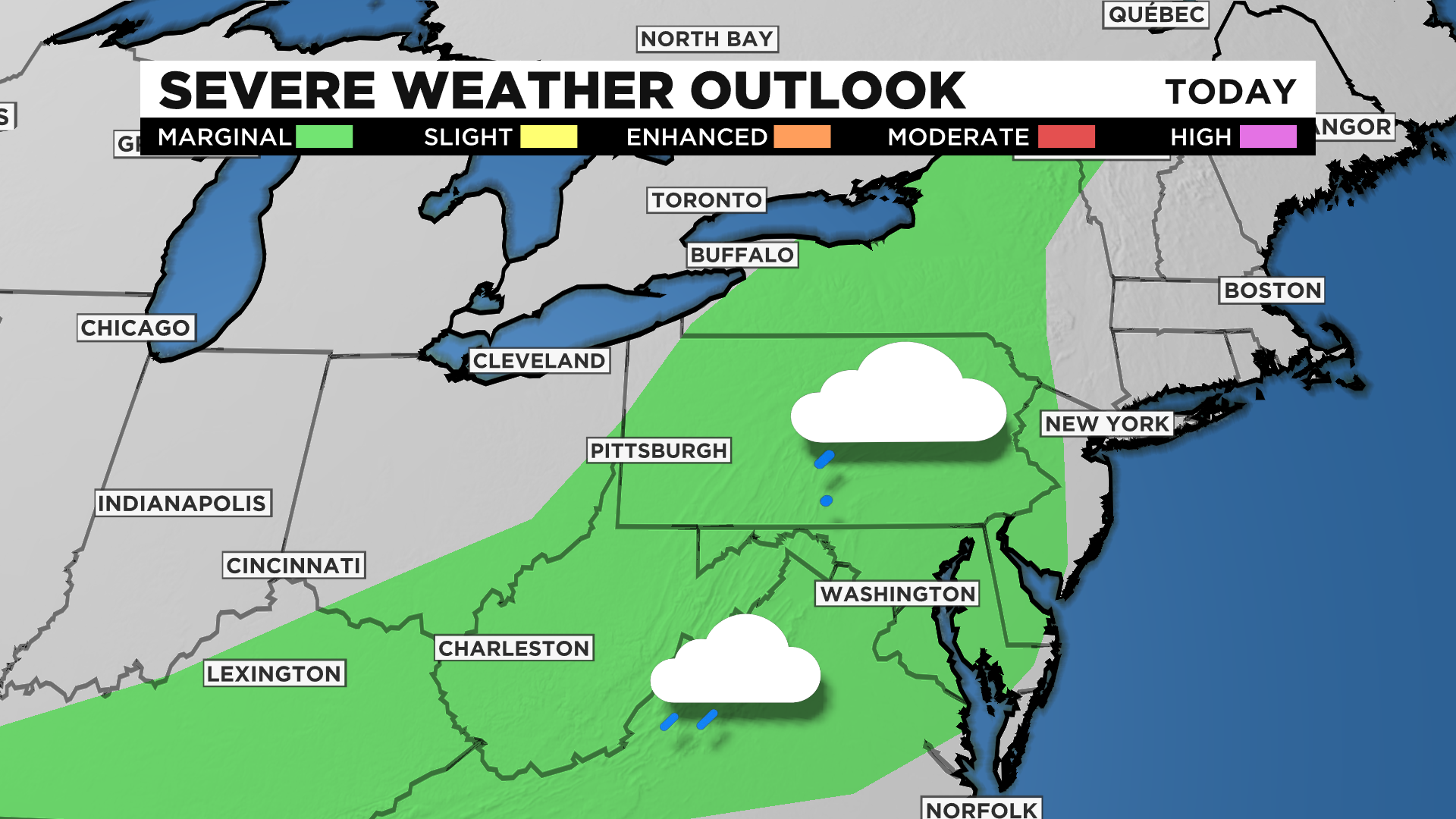
Pittsburgh Weather: Marginal Chance For Severe Weather
PITTSBURGH (KDKA) - There is a small chance for severe storms today with the best chance being just ahead of a cold front's passage across our area.
That will come tonight between 4:00 p.m. and 6:00 p.m.
WEATHER LINKS:
Current Conditions | School Delays & Closings | Local Radar | Weather App | Photos
Before the front passes, through, weak storms and rain showers are expected on and off.
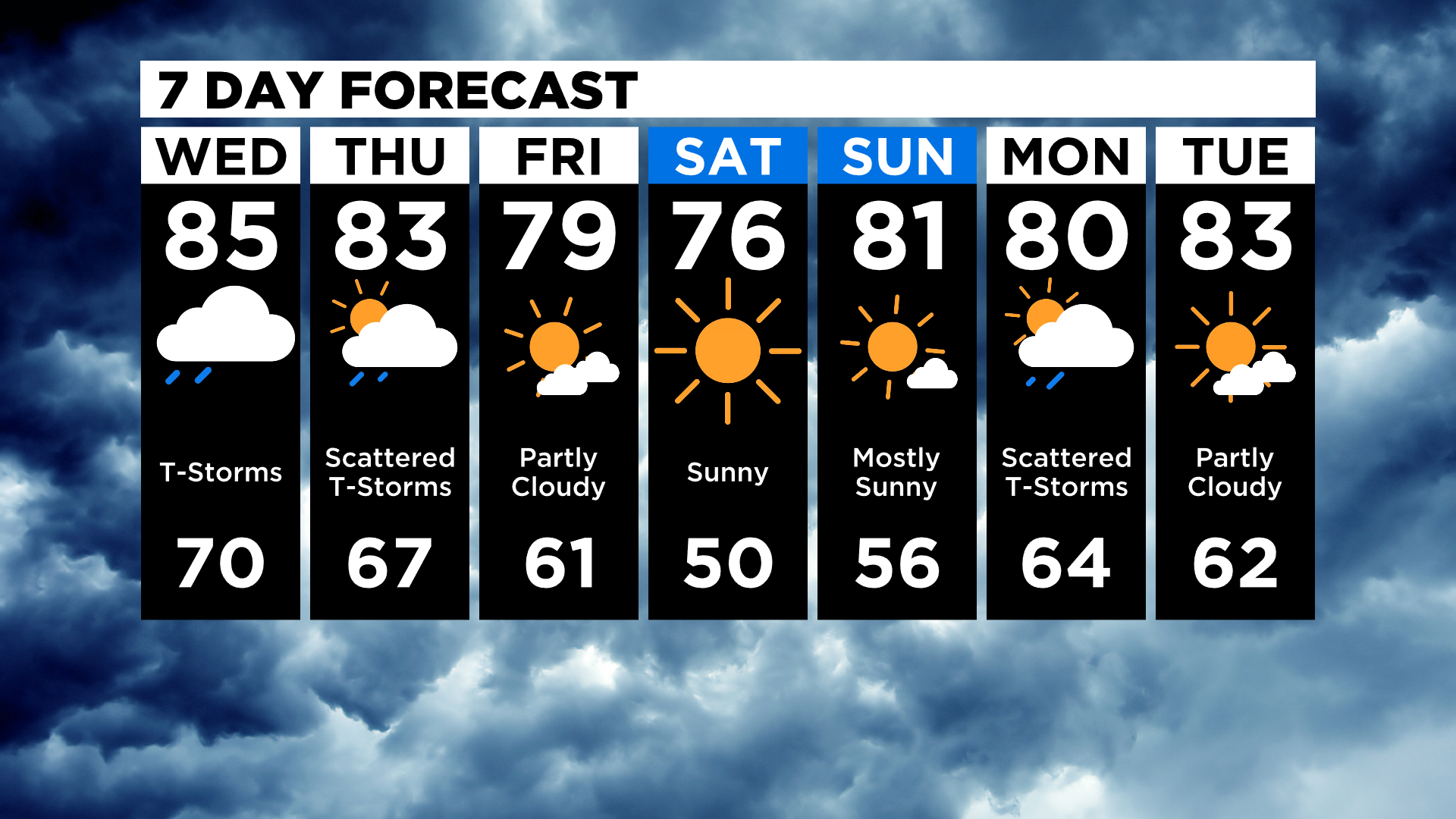
The highs today should reach back into the upper-80s and likely will be a degree or two warmer than yesterday's high of 83 degrees. However, any time there are rain chances throughout the day, the high temperature will be dependent on where the rain sets up.
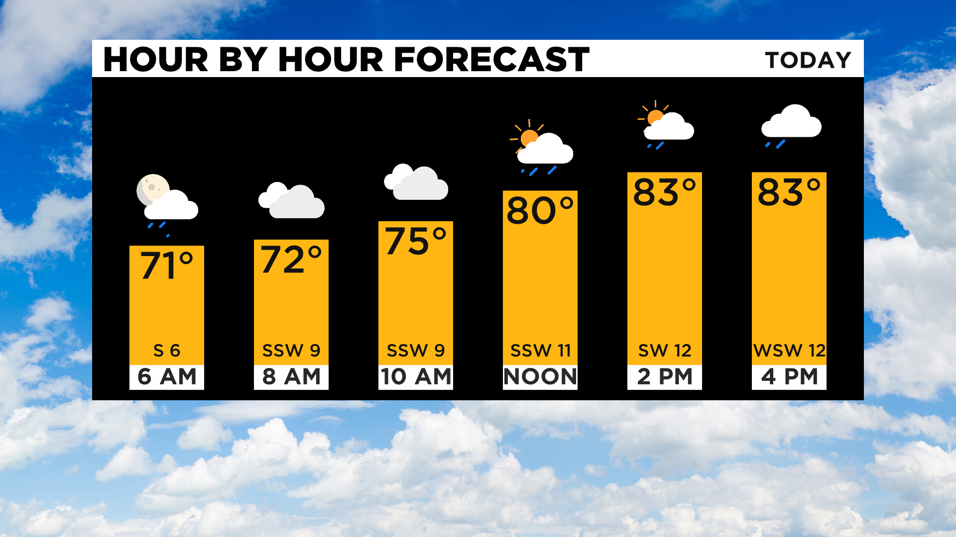
The rain totals today should be near a half-inch.
Looking ahead, tomorrow there will be a frontal boundary right on top of the area, bringing possible storms once again.
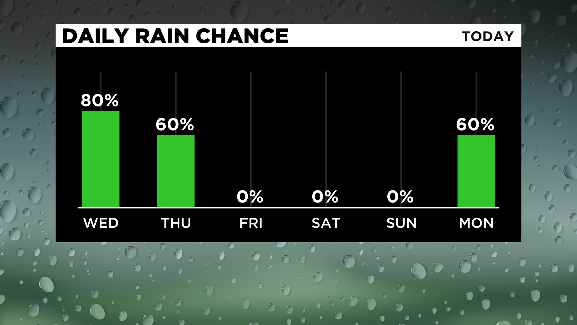
At this point, all model data jumps on a quick-moving "vort max" bringing a storm chance during the late-morning hours, possibly arriving around 10:00 a.m. and not lasting more than an hour. After that, it should be dry through the rest of the weekend with the next chance for rain coming Monday morning and potentially late Sunday night.
Temperatures will start to cool down for the weekend, with highs on Saturday potentially struggling to hit the mid-70s.
Stay up to date with the KDKA app, which you can download here.