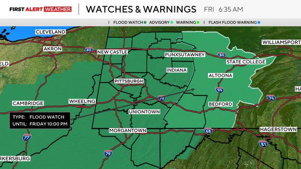
Flood watch for entire Pittsburgh area until 10 p.m. Friday

More rain, including the risk of flooding, will be possible for the Pittsburgh area on Friday.
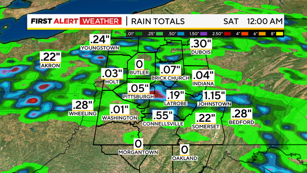
It looks like places between Interstate 80 and Interstate 70 will have the highest chance of rain. While most will still see just around half an inch, there will be isolated spots where 2 inches to maybe even 3 inches of rain will be possible.
Flood watch issued for most of area
In preparation for expected rain, the NWS has issued flood watches to be in effect through 10 p.m. KDKA is forecasting the heaviest rain working its way through as soon as 11 a.m. and going through 7 p.m. Because of the flood risk, Friday is a KDKA First Alert Weather Day.
Rain chances will have an impact on Friday's highs, with highs hit by the first afternoon rain of the day. Pittsburgh is forecast to see a high of around 80 degrees at noon. Temperatures will likely be in the upper 70s for the afternoon and evening. Humidity levels will be in the high range, so it'll be stuffy.
Rain chance returns Saturday
Looking ahead, we will have another chance for rain and a few isolated storms as a cold front sweeps through on Saturday afternoon. At this point, it looks like from 1 p.m. through 5 p.m. is the highest chance to see the rain. Saturday highs will likely be a little higher than Friday's high temperature of 80 degrees due to some sunshine in the afternoon and less rain. The high for Saturday is forecast as 81 degrees.
Sunday best day for outdoor plans
Sunday will likely be the warmest day of the weekend, with highs near 83 degrees. With Sunday being the only completely dry day happening this weekend, it looks like the best day for having outdoor plans. Low humidity and plenty of sunshine will also send those temperatures into the mid-80s with pleasant-feeling conditions. The pleasant conditions continue through Monday.
Looking ahead, hot weather is expected for the middle of the work week next week, with highs in the 90s possible on Tuesday, Wednesday and Thursday.


