Dry and seasonable conditions continue in Pittsburgh before weekend rain chances

After a day with numerous showers and thunderstorms yesterday, we are entering a quieter period in the weather pattern across the Upper Ohio Valley and Lower Great Lakes region.
An upper-level ridge will slowly build in, accompanied by surface high pressure in the next several days, leading to dry conditions and a gradual warming trend in temperatures.
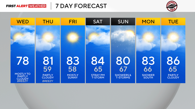
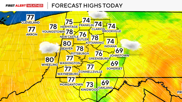
Today, most areas will see temperatures peak in the mid to upper 70s with lows in the mid to upper 50s to near 60.
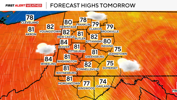
It will be breezy this afternoon with northwest winds sustained 15- 20 mph with locally higher gusts. Highs on Thursday will peak near 80 with sunny to partly cloudy conditions. The coolest morning out of the next few will come on Friday as surface high pressure sits across our region, leading to clear skies and light winds. Winds at the surface will gradually shift to the southeast, leading to a slow warming trend by Friday and Saturday.
The next system to bring us showers and thunderstorms will approach from the Midwest on Saturday. Most of Saturday will feature increasing clouds. An isolated afternoon or evening shower or storm is possible, but the higher probabilities of rainfall will be across Ohio and Indiana closer to the actual upper-level trough.
This disturbance will move overhead Saturday night into Sunday, maximizing chances of rain and non-severe thunderstorms. The upper trough will gradually dissipate over our region Sunday into Monday with isolated lingering rain chances on Monday over our southernmost counties.
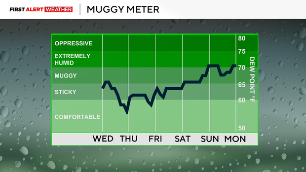
Warmer and drier weather looks to build in toward the middle part of next week.
This month has seen 4.77" of rain in Pittsburgh, which is slightly above normal by 0.91".
Less smoke is expected in our skies the next couple of days thanks to a shift in the winds aloft out of the north as opposed to northwest.