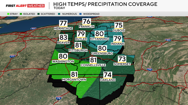
Cooler temperatures and stray showers move into the Pittsburgh area on Wednesday
After a hot and dry day on Tuesday, a weak trough of low pressure and its associated cold front are moving into western Pennsylvania this morning, bringing us some scattered to numerous showers.
WEATHER LINKS:
Current Conditions | School Closings & Delays | Submit Your Weather Photos
High-res model guidance is generally favoring areas from the Pittsburgh metro and points north and east with the best chance of showers this morning through 1-2 p.m., then some isolated activity in the Laurel Highlands as well.
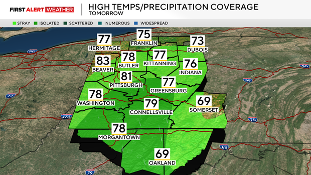
The cold front with this system is going to dissolve over the region tonight into Thursday. As winds still converge along this boundary, we will keep stray to isolated chances of precipitation in place through Thursday afternoon.
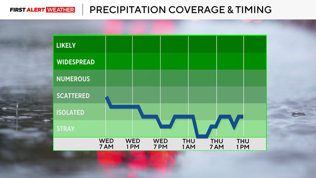
Some patchy dense fog is also likely on Thursday morning.
By Friday, high pressure moves in, leading to clearer skies across the region, which will lead into a short-lived warming trend this weekend.
High temperatures on Friday will reach the mid-80s, then upper 80s to near 90 are expected as southwest winds increase ahead of another stronger trough of low pressure and approaching cold front. This will bring a chance of some isolated afternoon and mostly evening storms Saturday into the predawn hours of Sunday.
As a second stronger trough embedded within the flow moves in Sunday night into Monday, there will be additional scattered showers and storms, followed by a strong cold front that will give us a preview of fall for early next week.
Below-average temperatures are expected from early into the middle of next week!

Stay up to date with the KDKA Mobile App – which you can download here!