Main development region for Atlantic tropical systems could become active in the coming days
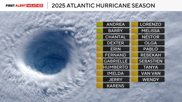
So far, the 2025 hurricane season in the Atlantic Basin has been fairly tame with only four short-lived and fairly weak tropical storms: Andrea, Barry, Chantal and Dexter. The East Pacific Basin has been much more active with Tropical Storms Ivo and Henrietta ongoing as of Aug. 8.
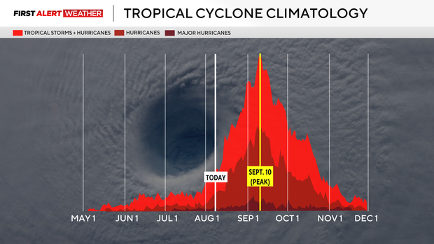
While things in the Atlantic Basin have been fairly quiet, we are just now reaching the climatological uptick in tropical storm and hurricane frequency. Just in time for this climatological upswing, there are some indications that the main development region for Atlantic tropical systems will become active in the next seven to 10 days.
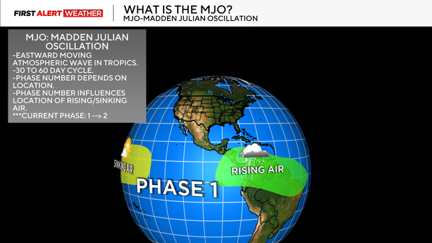
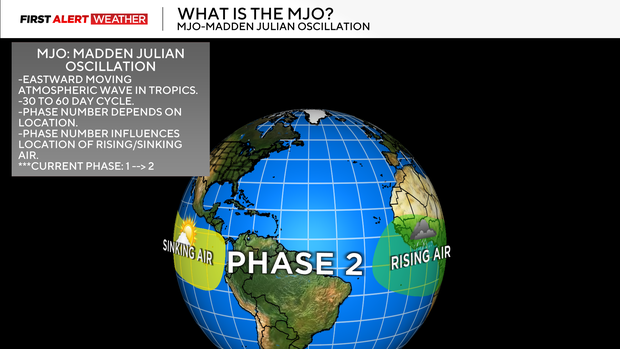
First, a large-scale atmospheric wave called the Madden Julian Oscillation or MJO is in a favorable phase to induce rising air for showers and storms in the Caribbean Sea and Eastern Atlantic Ocean. The MJO will likely remain in a favorable phase to favor increased shower and storm development in the Caribbean and Eastern Atlantic regions through Aug. 22.
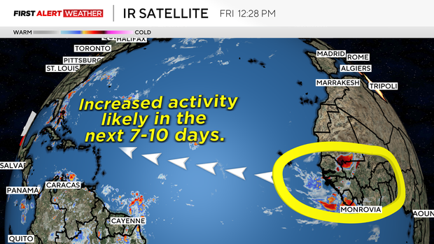
The National Hurricane Center is monitoring a few areas with low to medium probabilities for development over the next seven days in the Atlantic Ocean. One area in particular that is especially being monitored is a stronger wave moving west of the coast of Africa. This wave already shows up well with showers and storms on satellite.
Given that we are on the climatological upswing of hurricane season and these large scale features including the MJO are entering a favorable phase to maintain upward motion and t-storms in the tropical Atlantic, this is something to definitely watch as we approach the middle to back half of August.
At this point, it is too early to determine if the U.S. mainland will be impacted by any tropical systems directly, as that will depend on how the large scale weather pattern and upper air steering currents evolve within the next week to week and a half. So, if you see raw model postings of "doomsday" hurricane landfall predictions this early without any context or explanation, try to avoid consuming that content and stay up to date with trusted meteorologists and expert sources.