Weather Blog: Dangerous Cold Ahead
Dangerous wind chills are also expected to develop late Monday night.
Watch CBS News
Dangerous wind chills are also expected to develop late Monday night.

The Eagles, Flyers and Villanova have been on fire as of late.

Two areas of low pressure are converging on the greater Philadelphia region, set to leave behind significant snow and dangerously cold air. Snowfall begins around sunset and won't let up until Friday late in the morning.
The first winter storm of the new year will bring snow to our area late Thursday afternoon.

The first winter storm of the new year remains on track to arrive in the Delaware Valley on Thursday evening.

The first winter storm of the new year is on track to arrive in the Delaware Valley on Thursday evening.

By the time you read this, the Eagles-Dallas game will have been decided. Without Tony Romo, the Dallas Cowboys were expected to lean heavily on running back, De Marco Murray, who had been coming on strong of late. This season, he had surpassed 1,000 yards rushing for the first time in his three-year career.

A relatively tranquil weather pattern will help kick off the New Year in Philadelphia. However, don't expect it to last very long! The ingredients of our next snow storm are starting to organize in the central U.S.
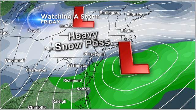
We'll enjoy cold but quiet weather for the first day of 2014, and then everything changes as two areas of low pressure set their sights on the area.

Who would have predicted 54-11, Eagles, at the start of that game last Sunday?

It looks like the Phillies are having some second thoughts about spending money.


If 203 victories, 2 Cy Young Awards and over 2,000 strike-outs aren't enough for entrance into the Hall of Fame, I'm not sure what is.

The best shot for snow was through the north and west-most counties, and Winter Storm Warnings remain in effect until early Sunday morning for that region.

Three times in a week, snow and ice and rain pelt our tri-state area. This latest storm looks to bring all three precipitation types again today.
Here is the latest update on this weekend's storm.

The next storm set to deliver fresh snow to the Delaware Valley continues to gather strength and moisture in the central U.S., eventually streaking through the Ohio Valley and arriving just in time for the weekend.

Snow will arrive in the Delaware Valley late Saturday morning/early afternoon.

But all eyes are focused on Saturday when our next storm arrives.
The Delaware Valley has begun to settle into a multi-day deep freeze. Even despite a break from stormy weather and sunshine in the forecast through the end of the work week, the mercury will struggle to hit the freezing mark the next few days.

The storm has behaved as expected and is ending.
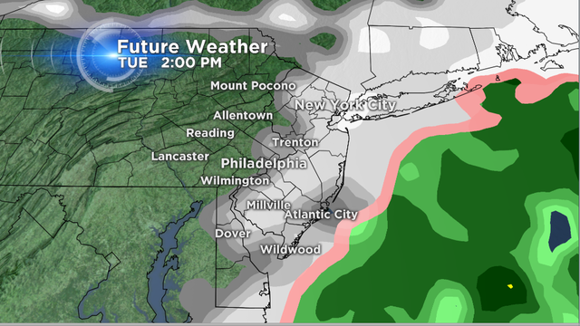
The storm has behaved as expected with the heaviest snow coming to an end early this afternoon.

Here we go again! The weather pattern continues to be very active. Snow lovers this is for you!

The weather pattern remains very active and if you are a snow lover, you are loving the forecast.