NEXT Weather: Next chance for rain, snow in Philadelphia area
Meteorologist Tammie Souza is tracking another storm that could bring another chance for winter weather. Tammie has more on how much snow our region can expect this weekend.
Watch CBS News
Meteorologist Tammie Souza is tracking another storm that could bring another chance for winter weather. Tammie has more on how much snow our region can expect this weekend.
A quick-moving system will bring some light rain and snow to the region Thursday, and another chance for 1-2 inches of snow in Philadelphia comes overnight Friday into Saturday.

A system headed our way overnight Friday into early Saturday morning could bring snow with the greatest amounts falling in South Jersey and at the Shore, Kate Bilo reports.

Grant Gilmore is tracking another round of snow in the Philadelphia region to start the weekend.

Grant Gilmore has the latest weather forecast for the Philadelphia region and says we could see our next winter storm this weekend.

Expect a quiet Wednesday night with decreasing winds and mostly clear skies.
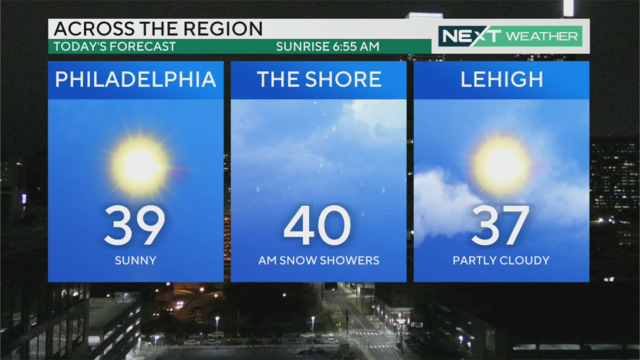
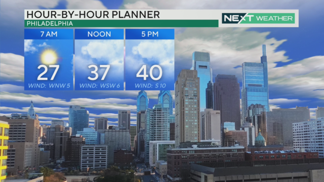
Temperatures stay on the chilly side Wednesday with highs in the mid-to-upper 30s, though blustery winds will keep feels-like temps in the 20s for most of the day.

Temperatures Wednesday stay on the chilly side with highs in the mid-to-upper 30s, though blustery winds will keep feels-like temps in the 20s for most of the day. The next chance for snow and rain in the Delaware Valley comes in the form of a quick clipper system on Thursday.

The Philadelphia region can expect mostly sunny but blustery conditions Wednesday with a high of 37. Thursday is likely to be partly sunny with light rain or snow possible late.

Bill Kelly has the latest weather forecast for the Philadelphia region after a winter storm moved through on Tuesday.

Significant snow fell in the Delaware Valley on Tuesday. Now that most of it is gone, what comes next?
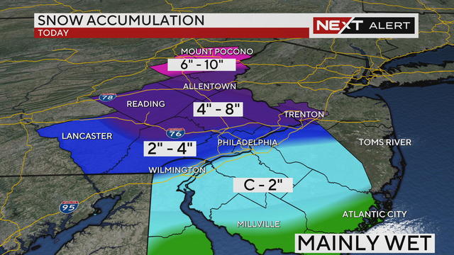
Snow changes over to rain in Philadelphia around 7 a.m. Tuesday. By the time the storm moves out, the city and areas along the I-95 corridor could see between 2-4 inches of snow.

Rain will transition over to snow in Philadelphia and along the I-95 corridor around 7 a.m. After a few hours, the storm will move out around noon, leaving between 2-4 inches, though areas north of the city and closer to the Lehigh Valley could get between 4-8 inches of snow.

Bill Kelly has the latest on Tuesday's winter storm.

Bill Kelly has the latest on the winter storm moving into the Philadelphia region on Monday night.

Rain will change to snow from north to south during the early morning hours, with heavy snow for portions of the area during the morning commute.

Monday stays mild with high temperatures near 50 degrees across the Delaware Valley, but late-night rain is set to transition to snow overnight. Accumulations won't amount to much in Philadelphia, but the Lehigh Valley and Poconos could see upwards of four inches of snow.

Bill Kelly has the latest on a storm that will bring a mix of wintry weather to the Philadelphia region this week.
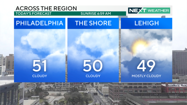
It'll be cloudy and mild across the Delaware Valley for your Super Bowl Sunday parties, but rain, slushy snow and gusty winds are on the way Monday and Tuesday.

Cloudy, mild weather continues in the Delaware Valley Sunday with highs near 50 degrees, but a winter storm with rain, slushy snow and gusty winds is forecast to move into the region overnight Tuesday. Tammie Souza has what to expect early this week.
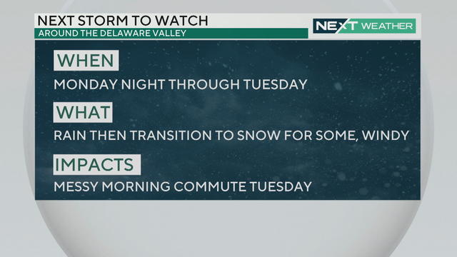
Mild conditions will continue through the weekend but a NEXT Weather Alert has been issued for Tuesday for rain and potential snow.

Enjoy this unseasonably warm Saturday with a high of 60 in Philadelphia - but a storm is coming Tuesday morning. Tammie Souza reports.

Friday and Saturday's high temperatures are 58 degrees, Kate Bilo reports. We could see showers Saturday and more significant rain or wintry mix Monday into Tuesday.

Bill Kelly says Friday's temps in the Philadelphia region will be a high of 56 as we enter the weekend.

Bill Kelly has the latest weather forecast for the Philadelphia region.