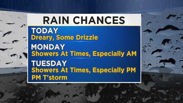
Weather: Milder With A Wet Finish To March
After feeling like late spring on Saturday with a high temperature of 77 degrees, a cool easterly wind flow has developed to finish off the weekend.
Watch CBS News
After feeling like late spring on Saturday with a high temperature of 77 degrees, a cool easterly wind flow has developed to finish off the weekend.
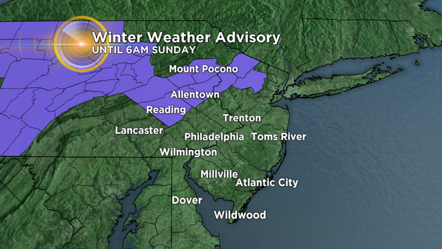
A slow-moving storm system will continue to move through the region today and tonight.
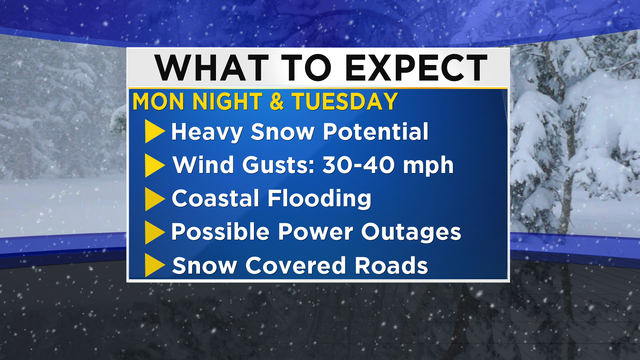
Snow will begin to arrive from southwest to northeast late Monday evening and continue on Tuesday.
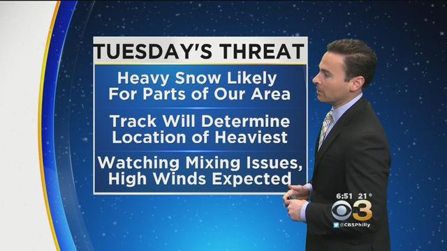
Cold air locked in place and available Atlantic Ocean moisture will bring potential for a late season rare snowstorm to the mid-Atlantic and Northeast.
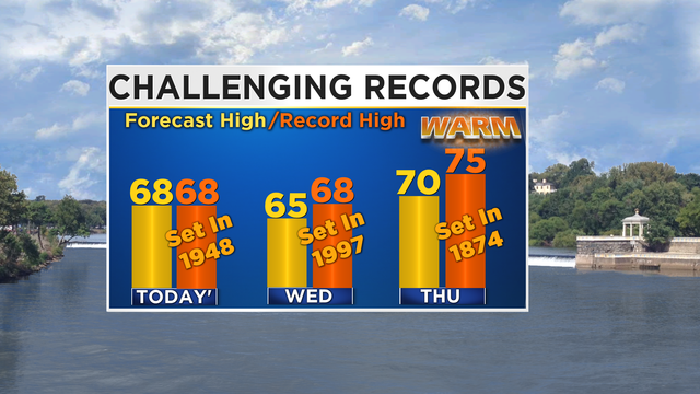
Expect near record high temperatures across the region again today with increasing sunshine this afternoon.
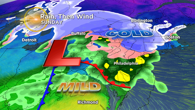
After a quiet and mild start to the weekend, the rest of today will be on the soggy side.
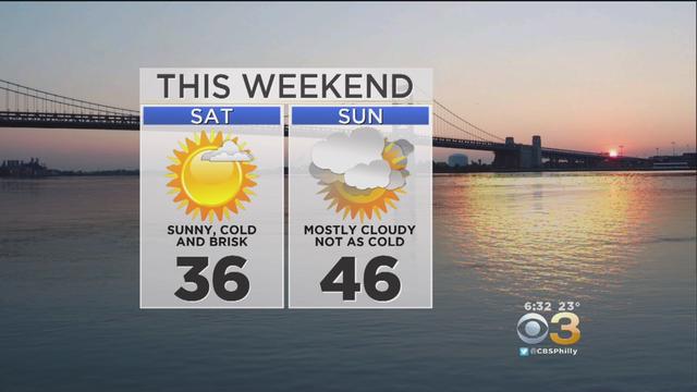
An Arctic air mass has moved into the Delaware Valley and will linger for the first half of the weekend.
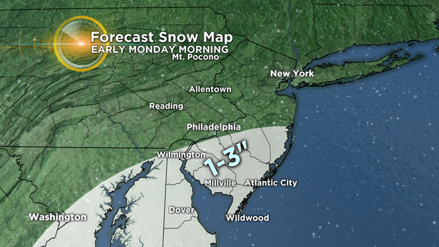
The best chance for accumulations will be across Delaware, southern New Jersey and the Maryland Eastern Shore.
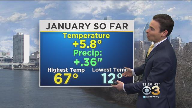
CBS Meteorologist Justin Drabick says cloudy days outnumbered sunny ones by a big margin.
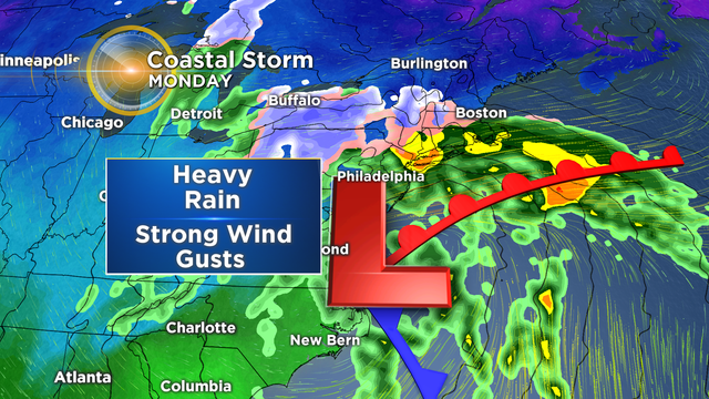
A large storm over the Southern US will track into the mid-Atlantic later tonight and intensify off the coast on Monday.
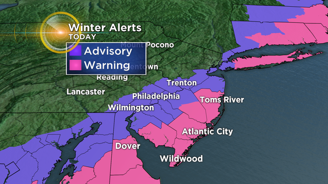
Winter is in full force this weekend with a plowable snowfall for the southern half of the region, and then reinforcing cold air behind the storm.
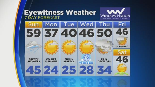
Today's storm system is performing as expected and initially dropped anywhere from a coating to 1.5" of snow across the region.
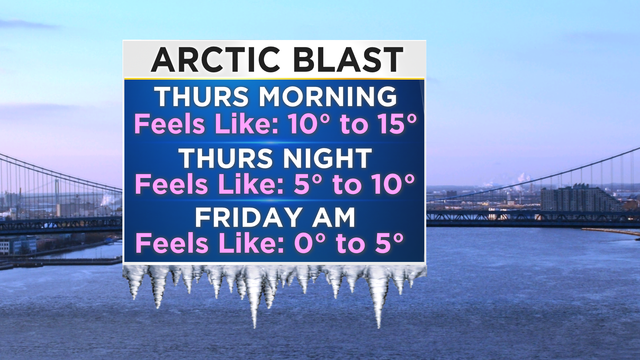
An Arctic cold front will move through the Delaware Valley early Thursday morning, bringing the coldest air since February.

The project involves one of nature's hardest working sea creatures, the mussel.
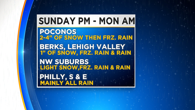
A winter weather advisory will be in effect for areas north of Philly Sunday afternoon through early Monday morning.
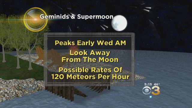
Next week, the Geminid Meteor Shower will arrive, along with the December Super Moon.

A weather pattern, more typical for the middle of Winter, will continue to develop and remain in place across the region into next week.
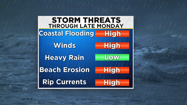
Post-Tropical Cyclone Hermine continues to remain a strong storm off the mid-Atlantic coast today.
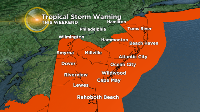
Hermine is still a Tropical Storm and is moving East-Northeast off the North Carolina coast with 60 mph winds.
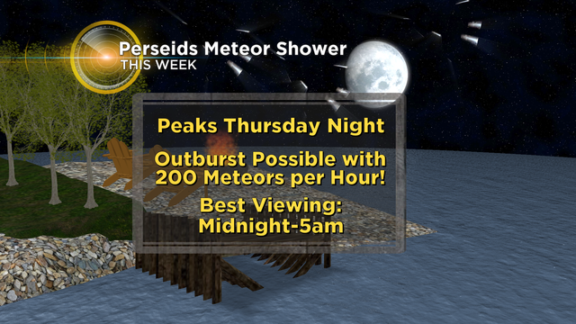
The Perseid meteor shower takes place every August and will be peaking this Thursday night into Friday morning.
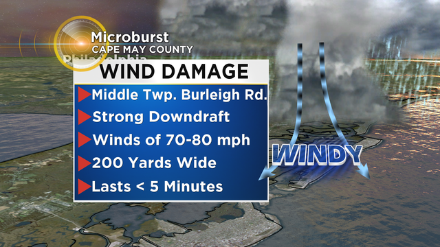
The National Weather Service classified Tuesday's damage at the Jersey Shore to be the result of a microburst.
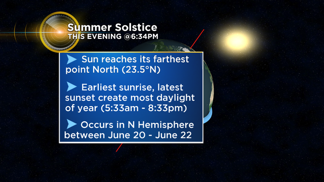
Hot and more humid conditions are in the forecast and they arrive right on schedule, as Astronomical Summer officially arrives tonight.

The only change this morning to this storm is that it is moving a little faster and a slight shift farther northward.
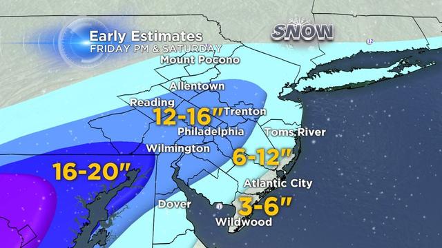
As of now, most of the day on Friday will be dry with the snow expected to arrive during the evening hours. The snow will then become heavy at times overnight through Saturday Afternoon.
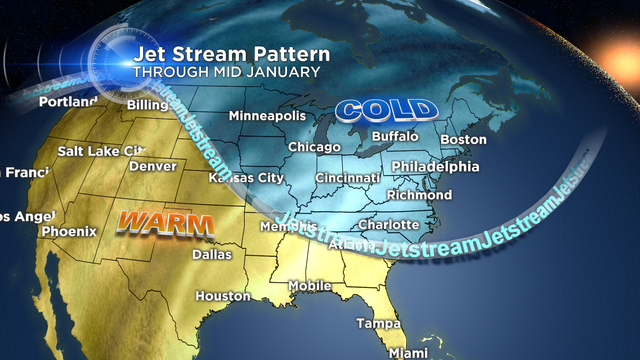
If you are excited about the milder temperatures, don't get used to it as another shot of arctic air is in the forecast.