Sunny Wednesday in Philadelphia before more Arctic temperatures this weekend. Here's the forecast.
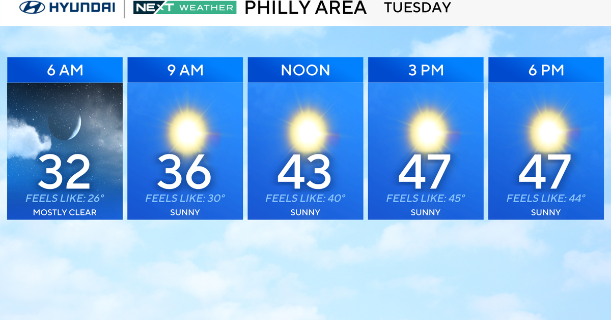
Wednesday is another comparatively mild winter weather day around the Philadelphia region, offering us a break between last week's arctic blast and another one on the way.
Watch for areas of black ice as some snow may have melted yesterday before refreezing overnight.
Temperatures are still well below normal, but we will be at least a few degrees above freezing during the afternoon hours, and that will help melt a little bit of the widespread snow still blanketing much of the Delaware Valley.
NEXT big weather change
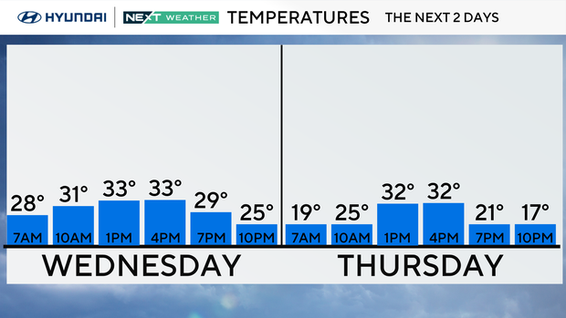
Quiet and similar conditions follow on Thursday and during the day Friday before our NEXT big change. The workweek is followed by an Arctic cold front with snow showers and squalls likely late Friday before the bottom falls out once again, which brings us to the weekend.
Temps will plunge on Friday night, and wind chills will struggle to get above zero MOST of the weekend. Winds themselves will likely gust to 30 mph, the strongest on Saturday during the day, with air temperatures staying in the teens. It won't be as strong Sunday, but wind chills will stay below 10 degrees, even during peak heating of the day.
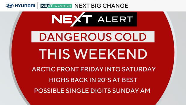
Our forecast low of 7 on Sunday morning would be the coldest temp of winter, if we drop that far. If the winds stay up, we may not, but regardless it will feel like below zero. The record low for Sunday is 2 degrees below zero, so no records will be set.
The bitter air will continue into early next week before moderating a bit midweek.
Here's your 7-day forecast:
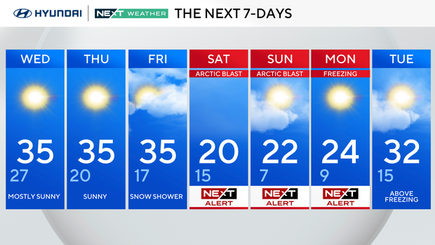
Wednesday: Mostly sunny. High 35, low 27.
Thursday: Sunny. High 35, low 20.
Friday: Snow shower. High 35, low 17.
Saturday: NEXT Weather Alert. High 20, low 15.
Sunday: NEXT Weather Alert. High 22, low 7.
Monday: NEXT Weather Alert. High 24, low 9.
Tuesday: Above freezing. High 32, low 15.