Mostly sunny skies with warm temps in the Philadelphia region Saturday. Here's the forecast.
We've got a gorgeous weekend for fall festivities underway!
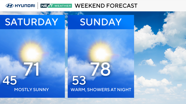
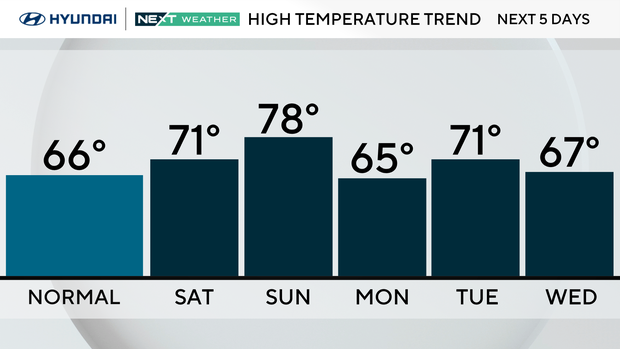
The weather is warming up as our next weather maker approaches, set to arrive and have some impacts late Sunday night into early Monday morning. We are heading to the low 70s on Saturday with some morning clouds breaking for sun, while Sunday will feature increasing clouds, southerly winds and temperatures in the mid-upper 70s.
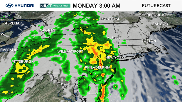
Sunday night into early Monday morning will bring our next round of showers and possibly a thunderstorm or two. Most should be during the overnight hours, but we will update you as the system moves closer.
The most impactful will likely occur between 12 a.m. and 3 a.m., so be aware that thunder could wake you from your sleep, meaning you may be a bit tired come Monday morning. It's possible that we could have some Monday commute impacts, but most of the energy should pass by then. There is the possibility that the center of the low could wrap a few showers back into the area by midday Monday as well, then it'll clear out with a gusty wind developing.
We really do need the rain, though, as of Friday, we have a deficit of nearly 1.5 inches, with much of the area in the "abnormally dry" area of the drought monitor released this past Thursday.
Here's your 7-day forecast:
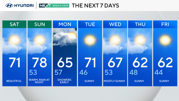
Saturday: Beautiful. High 71, Low 53.
Sunday: Warm, rain at night. High 78, Low 53.
Monday: Showers early. High 65, Low 57.
Tuesday: Sunny. High 71, Low 46.
Wednesday: Mostly sunny. High 67, Low of 53.
Thursday: Sunny. High 62, Low 48.
Friday: Sunny. High 62, Low 43.