Blustery but a bit warmer around Philadelphia Wednesday, weekend rain possible
The trend today is improvement. It's still chilly and breezy but nowhere near as cold and windy as it was yesterday when the high only reached 45 degrees, more reminiscent of Christmastime than mid-November.
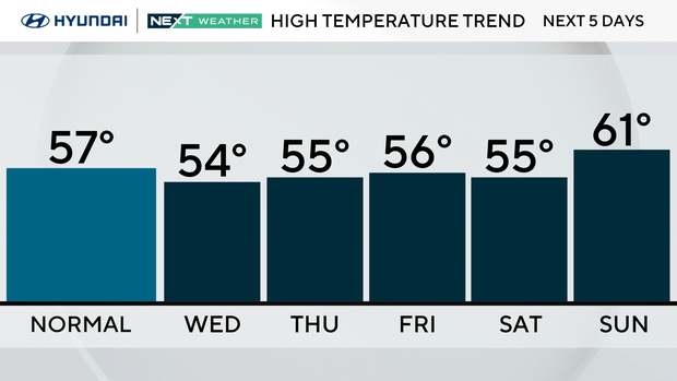
Highs today will climb back into the mid 50s but with winds gusting to 25 mph, it will feel like 50 at best.
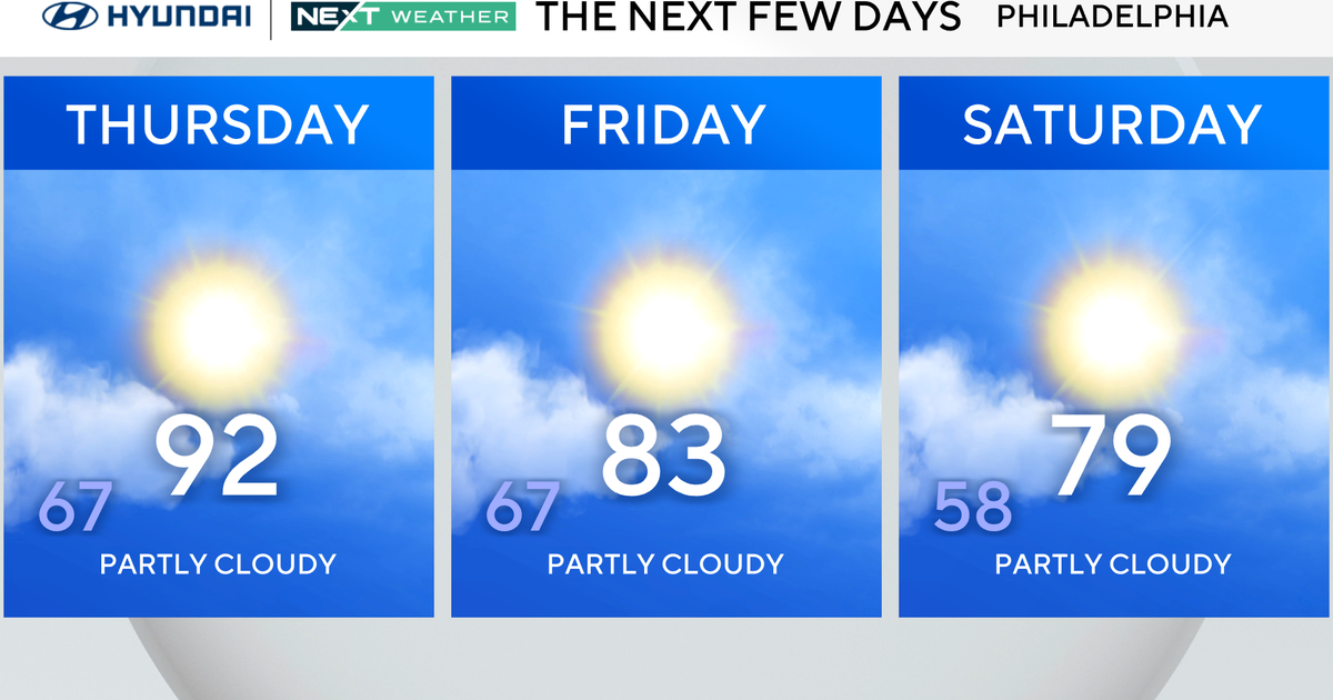
Dry weather is expected through the end of the week and into the weekend with our next chance of rain late Saturday night into Sunday as another front approaches. As the front clears, temps may warm into the 60s Sunday before falling again Monday and Tuesday of next week. In fact, we may be back the 40s for high temps.
Northern lights were visible in parts of our area last night, though the cloud cover obscured much of what could have been great viewing, as a severe geomagnetic storm took place. That storm will still be ongoing overnight tonight, though to a lesser extent.
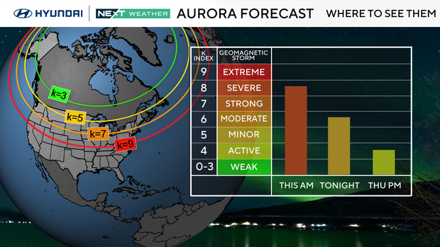
While there is still a small chance of seeing the northern lights, the best chance will stay well to our north – and some clouds could cause issues as well.
Stay warm!
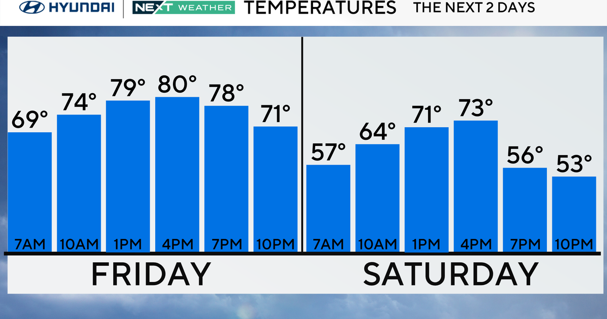
Here's your 7-day forecast:

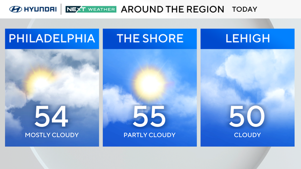
Wednesday: Breezy, not as cold. High 54.
Thursday: Mostly sunny. High 55, Low 43.
Friday: Nice day. High 56, Low 37.
Saturday: Mostly sunny. High 55, Low 34.
Sunday: AM rain. High 61, Low 48.
Monday: Mostly sunny. High 49, Low 40.
Tuesday: Shower chance. High 49, Low 37.