Philadelphia sees record-setting heat as heat wave raises possibility of storms. Here's the weather forecast.


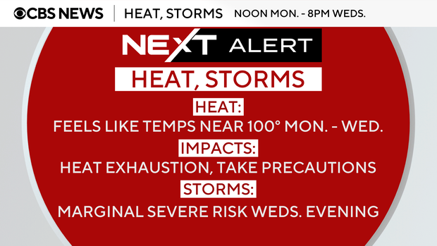
A NEXT Weather Alert is in effect through Wednesday for record heat with feels-like temperatures near 100 and the potential for strong storms Wednesday evening.
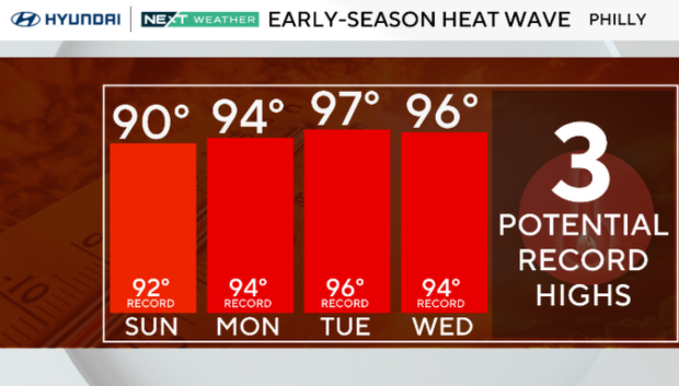
Sunday was the start of the first heat wave of 2026, and it will feel more like August than May for the first part of this week.
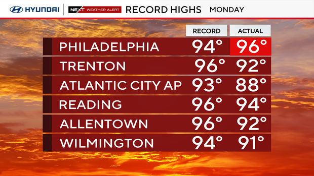
And on Monday, Philadelphia reached a record-high 96 degrees as of 2 p.m., breaking the previous high of 94 degrees set in 1962.
Monday's 96 degrees is the hottest temp in Philly since July 30, 2025, when it reached 97, and is one degree below the hottest temperature ever recorded in the city in the month of May. The hottest recorded day in May in Philadelphia's history is 97, set on May 30 and 31, 1991.
Dress comfortably, stay hydrated and take special care of pets.
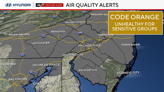
A code orange air quality alert has been issued for eastern and south central Pennsylvania and parts of New Jersey. A code orange means it's unhealthy for sensitive groups to participate in heavy outdoor activity.
It will be hot to sweltering hot through Wednesday. Each day we will be chasing new record highs in the low to mid-90s. Overnight lows will also be quite warm in the upper 60s and low 70s.
With all this heat, an isolated shower or storm is possible each afternoon and evening. You may not need an umbrella until late in the day Wednesday as a cold front moves through with scattered, gusty thunderstorms.
Temperatures will plummet nearly 30 degrees behind Wednesday's front, leaving temperatures Thursday through Memorial Day in the mid-60s to low 70s with the chance of passing showers each day.
In the Philadelphia area, a heat wave is a stretch of three or more consecutive days in the 90s.
So, while we feel like summer now, plan on a cooler and possibly wetter holiday weekend.
NEXT big changes
- A cold front brings gusty storms later in the day Wednesday. It's too early to gauge the severe potential, but it is possible.
- Behind that cold front, much cooler air arrives, and highs will drop nearly 30 degrees in just 24 hours to the upper 60s on Thursday. That's below our normal high in the mid-70s this time of year.
Here's the 7-day forecast:
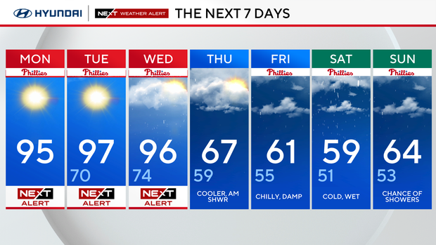
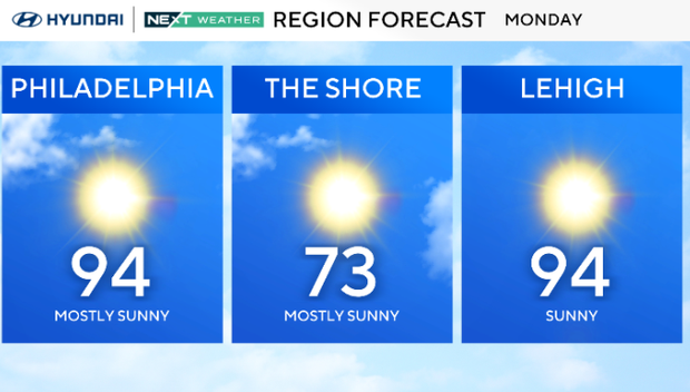
Monday: NEXT Weather Alert. High 95
Tuesday: NEXT Weather Alert. High 97, low 70.
Wednesday: NEXT Weather Alert. High 96, low 74.
Thursday: Cooler, a.m. showers. High 67, low 59.
Friday: Chilly, damp. High 61, low 55.
Saturday: Cold, wet. High 59, low 51.
Sunday: Chance of storms. High 64, low 53.


