Philadelphia could hit record-breaking high temps Wednesday, tracking evening storms. Here's the forecast.
We'll continue with shorts and T-shirts on Wednesday in the Philadelphia region. While a stray shower or two is possible, it's unlikely you will need your umbrella until the evening, as showers and storms may develop if you have nighttime plans.
Breezes will remain, but it's a warm southerly breeze, not the biting northwest chill.
NEXT big weather changes
Wednesday will feature likely record-breaking high temperatures in the low-middle 80s, but it'll also come with a better chance for some showers and thunderstorms, especially during the evening timeframe.
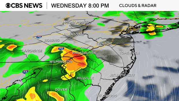
A relatively strong cold front will approach the region from the north late Wednesday afternoon, which could help spur a few more gusty showers and thunderstorms.
The cold front will then stall out across the region on Thursday, dropping temperatures back into the 50s.
By Easter Weekend, we'll be tracking a few more showers and another cold front that looks to bring showers/storms by the later afternoon and evening on Easter Sunday. Plan on doing your egg hunts in the morning!
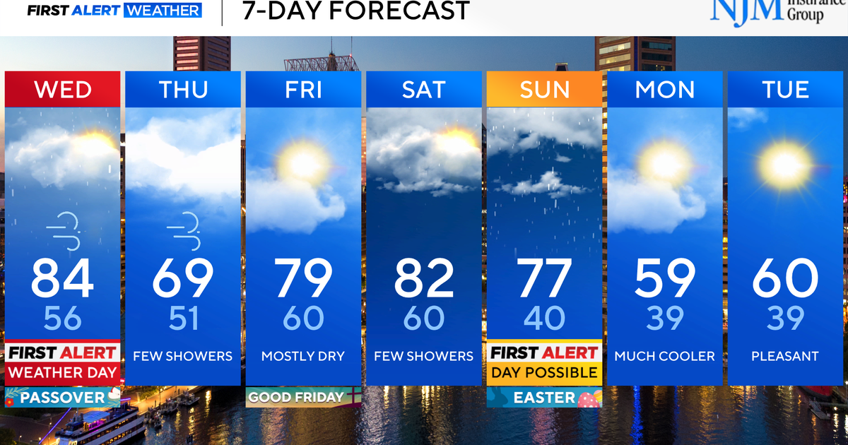
Here's your 7-day forecast:
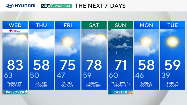
Wednesday: Warm, p.m. storms. High 83, low 63.
Thursday: Cloudy, cooler. High 58, low 50.
Friday: Partly cloudy. High 75, low 47.
Saturday: Stray showers. High 78, low 59.
Sunday: P.m. showers, storms. (Easter). High 71, low 60.
Monday: Sunny cooler. High 58, low 46.
Tuesday: Partly cloudy. High 59, low 39.