Morning snow showers moving out of the Philadelphia region before mild weather sets in. Here's the forecast.
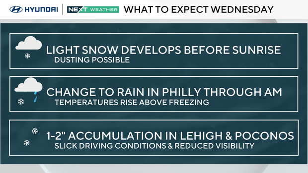
Plan on some morning snow showers around the Philadelphia region for your drive in to work, school or the gym on Wednesday. Impacts should be relatively minor and we don't expect this snow to stick, but be careful out on the roads.
We're seeing a band of snow showers crossing Philadelphia between around 5-5:30 a.m. These will move off the coast by around 7 a.m.
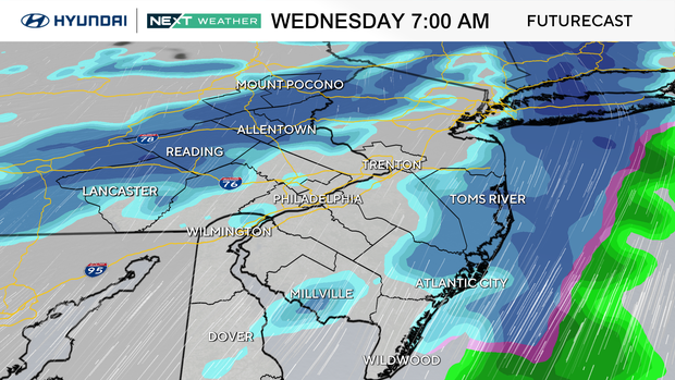
The chance for any accumulation looks limited to areas north of Interstate 78, with up to an inch for parts of the Lehigh Valley and 1-2 inches for the Poconos.
A jacket will be needed to start the day, but we'll warm to the mid-40s by the afternoon hours, with a few breaks of sun. This is great weather for melting any piles of snow left by the plows!
NEXT big change
A stronger system will track by to our south Thursday night, mostly missing our region. There is a chance we could be clipped by some light rain or snow showers to the south, but it doesn't look like this will have a big impact either.
The weekend is looking mild and dry before another big chill moves into the area early next week that has the potential to bring additional accumulating snow to the region, along with cold temps.
Here's your 7-day forecast:
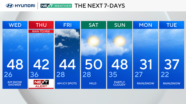
Wednesday: Morning snow shower. High 48, low 26.
Thursday: Rain and mix. High 42, low 36.
Friday: AM icy spots. High 44, low 28.
Saturday: Mild. High 50, low 28.
Sunday: Partly cloudy. High 48, low 35.
Monday: Rain/snow. High 31, low 27.
Tuesday: Rain/snow. High 37, low 22.