Flood watch in effect Tuesday in Philadelphia region as rain sticks around. Here's the weather forecast.
While it will not be as active as Monday, the off-and-on rain, with an occasional thunderstorm, will continue to blanket the Philadelphia region Tuesday.
Humidity levels will be high early but start to fall later in the day as dry air filters in behind the front. The showers could include heavy rain at times, so have the umbrella with you as you head out. Also, watch for any debris from Monday night's storms, especially in heavily wooded areas.
A flood watch is in effect until 6 a.m. Tuesday for parts of Delaware, the I-95 corridor and South Jersey.
NEXT big weather changes
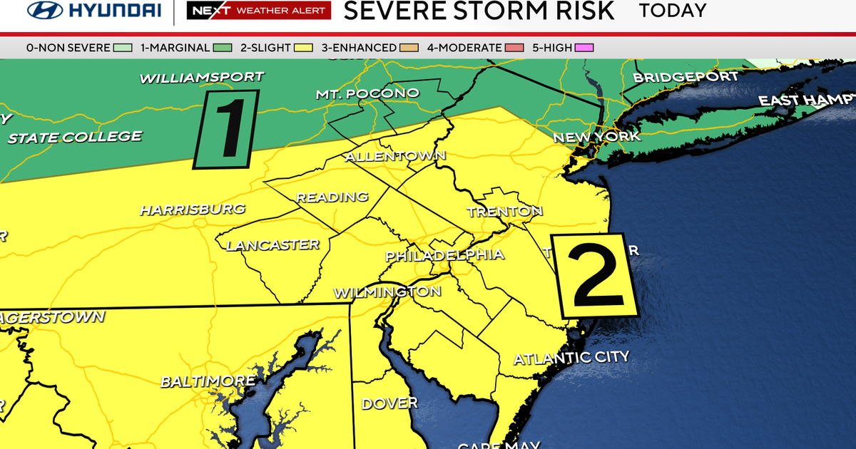
Fortunately, the severe threat in our region has ended, but the showers and flooding rain potential have not.
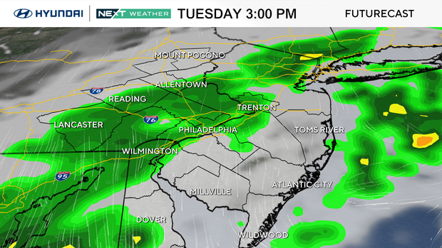
On Monday, parts of our area picked up several inches of rain, so localized flooding will continue during the day on Tuesday.
The next big chance occurs on Wednesday, when the sunshine returns and humidity levels drop back to very comfortable conditions.
The days are very long and the sun angle is at its highest point, so be sure to lather on the sunscreen if headed outside. Wednesday should be a fabulous beach, pool or waterpark day.
Thursday, the World Cup Match returns to Philly, and so does our next rain chance.
At this point, it looks to be late in the evening, so impacts should be at a minimum but your NEXT WEATHER TEAM will keep you updated as those storms will likely go into Friday and Saturday as well.
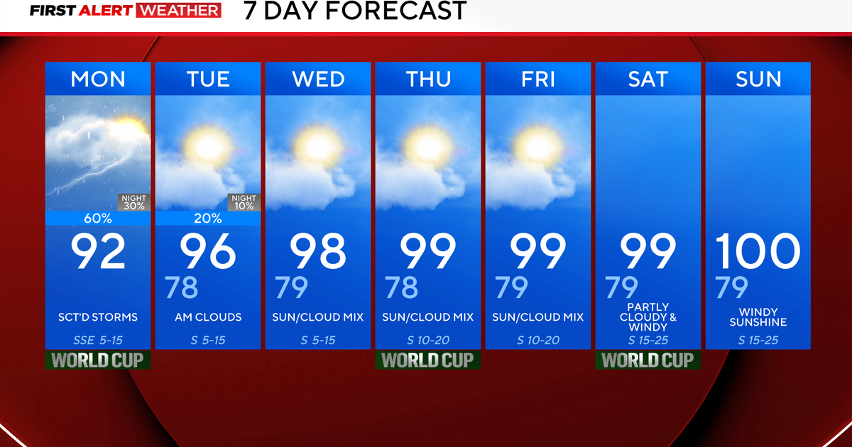
Here's your 7-day forecast:
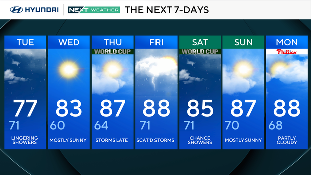
Tuesday: Lingering showers. High 77, low 71.
Wednesday: Mostly sunny. High 83, low 60.
Thursday: P.m. storms. 87, low 64.
Friday: Scattered storms. High 88, low 71.
Saturday: Chance of showers. High 85, low 71.
Sunday: Mostly sunny. High 87, low 70.
Monday: Partly cloudy. High 88, low 68.