Wind chills in teens and 20s in Philadelphia area Tuesday after snowstorm. Here's the weather forecast.
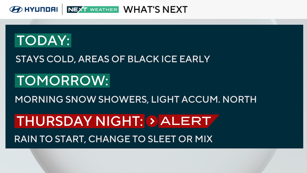
On the heels of a major blizzard across the Delaware Valley and Jersey Shore, there are two things to be aware of Tuesday: Cold temperatures and potentially dangerous icy spots.
Due to the above-freezing temperatures Monday, quite a bit of snow melted and all that liquid sitting around on untreated areas has frozen up.
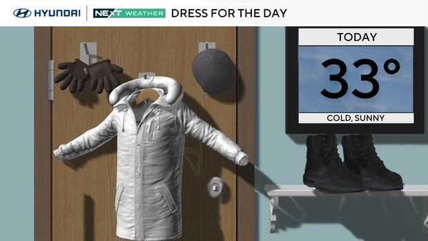
Jackets, coats and hats are all needed today as highs barely climb above freezing despite a good deal of sunshine. Feels-like temps will reach the mid-20s at best during the warmest part of Tuesday.
NEXT big weather changes
We're tracking a clipper that will bring more snow showers Wednesday morning. This could have minor impacts for the morning commute, but the chance for any accumulations looks limited to areas north of Interstate 78, with up to an inch for parts of the Lehigh Valley and 1-3 inches for the Poconos.
The NEXT Weather team will monitor if it looks like this system will cause problems for the commute near the city, but as of now doesn't look super impactful.
We've issued a NEXT Weather alert for Thursday, when a stronger system will track by to our south at night.
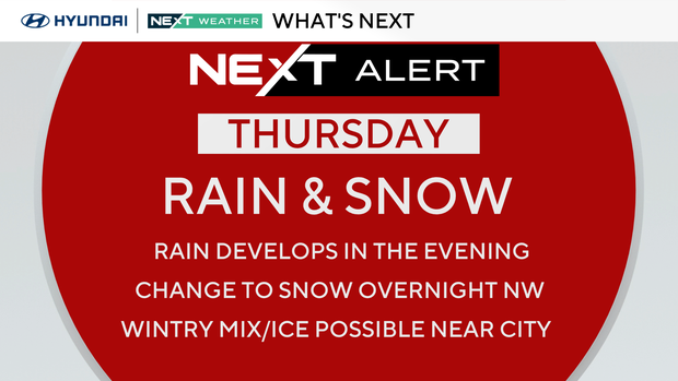
This will likely begin as rain, but could change over to a brief period of snow or a wintry mix on the northernmost edge of the storm through the overnight hours, with some possible slippery spots.
The weekend is looking mild and dry before another big chill moves into the area early next week.
Here's your 7-day forecast:
Tuesday: Sunny and cold. High 33.
Wednesday: AM snow shower. High 48, low 26.
Thursday: NEXT Weather Alert for rain and snow. High 42, low 36.
Friday: AM icy spots. High 44, low 28.
Saturday: Pleasant. High 53, low 28.
Sunday: Mild. High 52, low 35.
Monday: Much colder. High 31, low 27.


