Chance of storms Thursday in Philadelphia region with feels-like-temps in triple digits. Here's the forecast.
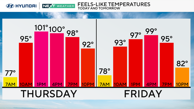
The heat is on in the Philadelphia region as temperatures climb into the lower 90s, but it will feel more like 100-105 degrees thanks to tropical humidity.
Plan for frequent breaks and plenty of water if you're spending time outdoors.
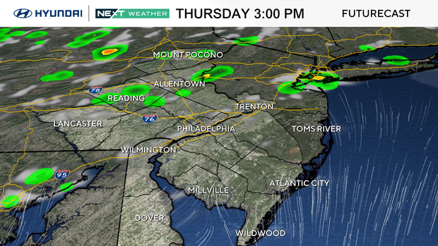
While much of the day stays dry, scattered thunderstorms will develop during the afternoon and evening.
A few storms could become strong with damaging wind gusts, torrential downpours, and localized flash flooding. Keep an eye on the radar if you have outdoor plans later on Thursday.
NEXT big weather changes
The biggest story through the weekend remains the combination of dangerous heat, oppressive humidity and daily storm chances.
Highs will stay in the lower 90s through at least the weekend, with heat index values frequently reaching the triple digits.
Each afternoon and evening will bring the opportunity for scattered showers and thunderstorms, but not everyone will see rain every day.
Some storms could produce heavy rainfall and isolated strong winds, especially on Friday and Saturday evenings.
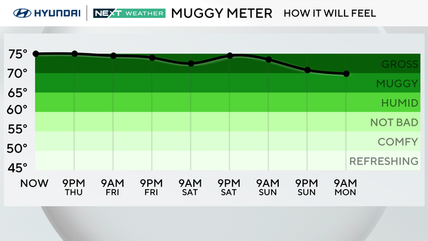
Relief from the heat looks limited until early next week, when temperatures and humidity may begin to ease.
Here's your 7-day forecast:
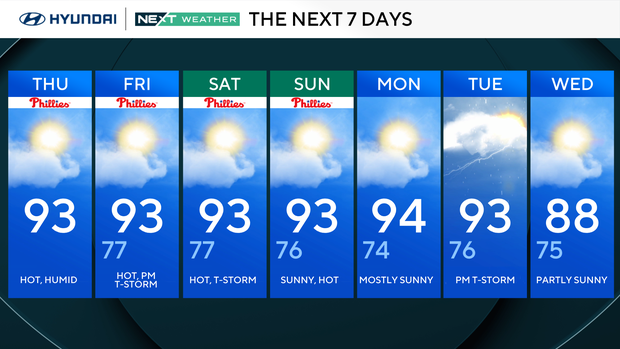
Thursday: Hot, pop-up storm. High 93
Friday: Hot, thunderstorm. High 93, Low 77
Saturday: Hot, thunderstorm. High 93, Low 77
Sunday: Mostly sunny. High 93, Low 76
Monday: Mostly sunny. High 94, Low 74
Tuesday: Few showers. High 93, Low 76
Wednesday: Partly cloudy. High 88, Low 75


