Coastal storm to bring heavy rain to Philadelphia region Sunday. Here's more on timing and the weather forecast.

The coastal storm continues to track farther offshore, lowering expected rain totals for Sunday in the Philadelphia region.
The Philadelphia Marathon looks mostly dry, with rain spreading into the city during the afternoon and becoming more likely as the Eagles game goes on.
Most spots along and northwest of I-95 will see a half inch or less, with three-quarters of an inch to an inch possible across Delmarva and parts of coastal New Jersey. The heaviest rain is expected at the Jersey Shore Sunday evening, where it could overlap with high tide and cause minor flooding in low-lying areas.
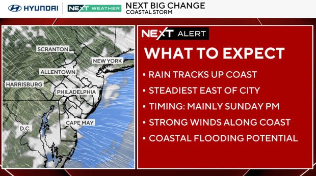
NEXT big weather changes
Rain tapers off Sunday night, setting up a dry stretch from Monday through most of Wednesday.
Cooler weather settles in, and that stretch looks like the best window for early Thanksgiving travel. Conditions could start to deteriorate Wednesday night as another storm develops along the East Coast.
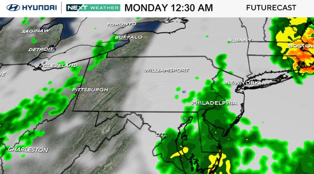
Thanksgiving Day is the main period to watch for travel impacts. The forecast favors rain across the region, with 1 to 2 inches possible Thursday into Friday.
Gusty winds could add to travel issues if the storm strengthens. A few flakes could mix in across the southern Poconos or Lehigh Valley if precipitation starts before dawn Thursday.
Forecast models still differ on when the rain will begin, where the storm will track and how strong it will get. Those details will determine whether the rain reaches us during Wednesday night travel and how much wind we see on Thanksgiving Day.
Here's your 7-day forecast:
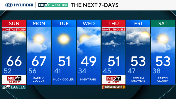
Sunday: NEXT Weather Alert for coastal storm. High 66, Low 52
Monday: Partly cloudy. High 67, Low 56
Tuesday: Much cooler. High 51, Low 41
Wednesday: Rain at night. High 49, Low 34
Thursday: NEXT Weather Alert. High 51, Low 45
Friday: Few showers in the morning. High 53, Low 47
Saturday: Partly cloudy. High 53, Low 38
Get the latest weather info on the CBS News Philadelphia app.