Temps drop Thursday after Philadelphia region hit record highs Wednesday. Here's the weather forecast.
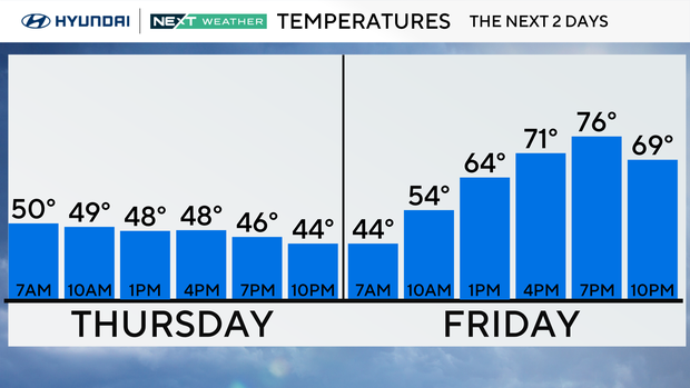
The change in temperatures will be dramatic after a record-setting 84 degrees on Wednesday in the Philadelphia region. We're going from shorts and T-shirts to needing the light coat on Thursday, with afternoon temps only in the upper 40s and low 50s.
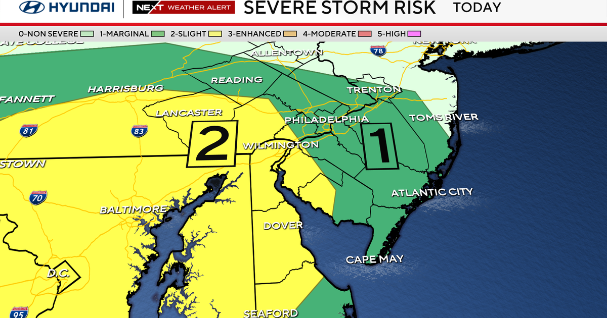
Cloudy skies will be the rule, along with a general dampness to the air and ground. While not a rainy day, you may need that umbrella from time to time as light showers are possible.
NEXT big weather changes
The rollercoaster ride continues with another run at record-breaking temps on Saturday in the low 80s. Another cold front will push through the area on Easter Sunday, bringing rain and much cooler temperatures than Saturday. With the way things are looking, it will be a much better day on Saturday to plan your egg hunts outside.
Next week, we'll be back to more normal highs for this time of year, which are upper 50s and low 60s.
Here's your 7-day forecast:
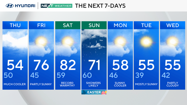
Thursday: Much cooler. High 54, low 50.
Friday: Partly sunny. High 76, low 45.
Saturday: Record warmth? High 82, low 59.
Sunday: Showers likely. (Easter). High 71, low 60.
Monday: Sunny cooler. High 58, low 46.
Tuesday: Partly cloudy. High 59, low 39.
Wednesday: Warm, p.m. storms. High 83, low 63.