Unsettled weather in Philadelphia region this week with fall set to officially begin. Here's the forecast.

Monday in Philadelphia stays cool and unsettled, with the front stalled just south of the region and scattered rain chances, especially across southeastern Pennsylvania, South Jersey and Delaware.
Highs will struggle to get out of the 60s (low 70s for the city), with the better chance for more widespread rain holding off until Tuesday.
NEXT big weather changes
Fall arrives Tuesday at 8:04 a.m. and ushers in unsettled and much cooler weather.
Tuesday looks like the wettest day of the week as the front briefly lifts north, bringing widespread rain chances while temperatures remain stuck in the 60s.
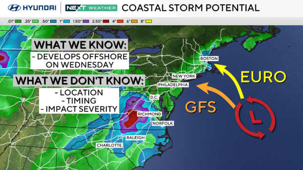
Rain chances ease Wednesday into Thursday as the front shifts south, but a developing coastal low could bring rain back into the picture late Thursday into Friday.
There's still plenty of uncertainty with that system, and a track farther offshore would keep much of the region drier. Persistent onshore winds will also increase the coastal flooding threat beginning Tuesday, with moderate tidal flooding possible Wednesday.
Here's your 7-day forecast:
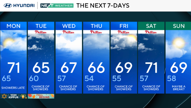
Monday: Showers late. High 71, Low 65
Tuesday: Chance of showers. High 65, Low 60
Wednesday: Chance of showers. High 67, Low 57
Thursday: Chance of showers. High 66, Low 54
Friday: Chance of showers. High 69, Low 55
Saturday: Chance of showers. High 71, Low 57
Sunday: Maybe a break? High 69, Low 58
Get the latest weather info on the CBS News Philadelphia app.


