Winter Storm Warning in effect as snow is expected across the Philadelphia area. Here's the forecast.

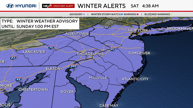
A Winter Storm Warning is now in effect across the Philadelphia region through early Sunday morning. We've upped the expected totals in our forecast and are under a NEXT Weather Alert for this storm.
Saturday is your day to prepare for snow. Break out the snow shovel, fill up the gas tank, get some groceries, and fire up the snow blower.
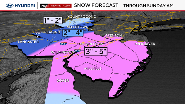
Snow maps show South Jersey, Philadelphia with highest snow totals
Our entire region is under a winter weather advisory. The alert begins in the Philadelphia area at 7 p.m. Saturday and will last until 1 p.m. Sunday.
These areas are also under a winter storm warning:
- Gloucester County;
- Camden County;
- Burlington County;
- Delaware County;
- Philadelphia;
- Parts of Chester, Bucks and Montgomery counties.
A system arrives between 5 p.m. and 7 p.m. with some light rain and transition to snow through midnight.
Around 8 p.m. to 10 p.m., the snow gets going.
We have upped the snow totals in our forecast to 3-5 inches for entire area from Pennsylvania counties close to I-95 corridor, including Philly, to the shore.
The Lehigh Valley now looks to be included in the storm too, with 2 to 4 inches of snowfall a possibility.
Snow will continue through Saturday night and end quickly on Sunday morning from west to east between 6:30 a.m. to 10 a.m.
Then winds kick in with 20-30 mph gusts that could blow some snow drifts around.
Skies Sunday afternoon with be partly cloudy but some snow squalls possible.
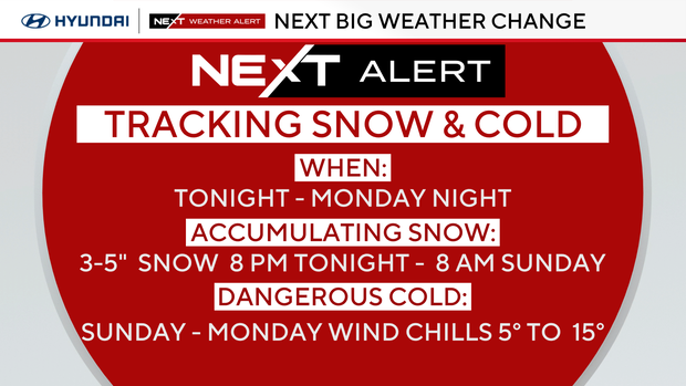
NEXT big change in the forecast
Our coldest push of Arctic air arrives on NW winds behind the storm on Sunday.
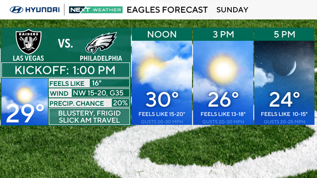
The Eagles game will be bitterly cold by kickoff and getting colder by the final play.
Monday will be the coldest day yet. Temperatures will fall into the 20s and winds will create a feel-like in the teens and single digits through Monday.
Looking ahead
We slowly warm after Monday with the first temperature above average and the first 50s since before Thanksgiving arriving by Friday.
REMINDER: we are still in fall. It's not winter yet. The winter solstice begins Dec. 21.
Here's your 7-day forecast:
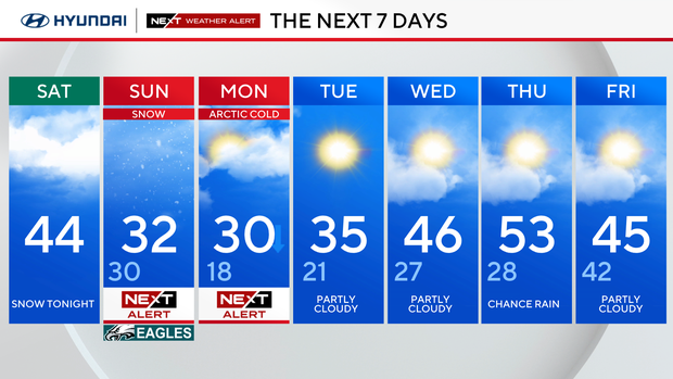
Saturday: Clouds and snow at night. High 44, Low 25.
Sunday: NEXT Weather Alert for morning snow. High 31, Low 28.
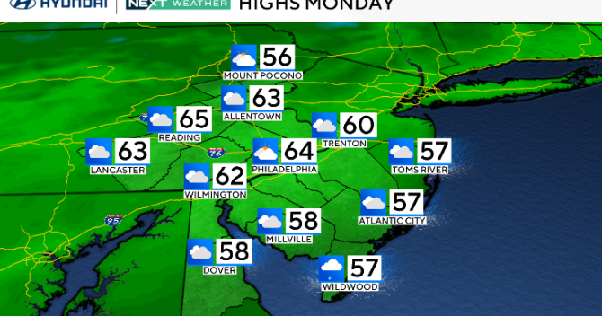
Monday: NEXT Weather Alert for bitter cold. High 31. Low 18.
Tuesday: Bitterly cold. High 36, Low 21.
Wednesday: Slightly bitter. High 45, Low 26.
Thursday: Milder. High 55, Low 32.
Friday: Mild. High 45, Low 42.