Showers move in Saturday night ahead of a gusty Sunday in Philadelphia. Here's the forecast.
Welcome to the weekend everyone. It will certainly be a weekend of several different changes.
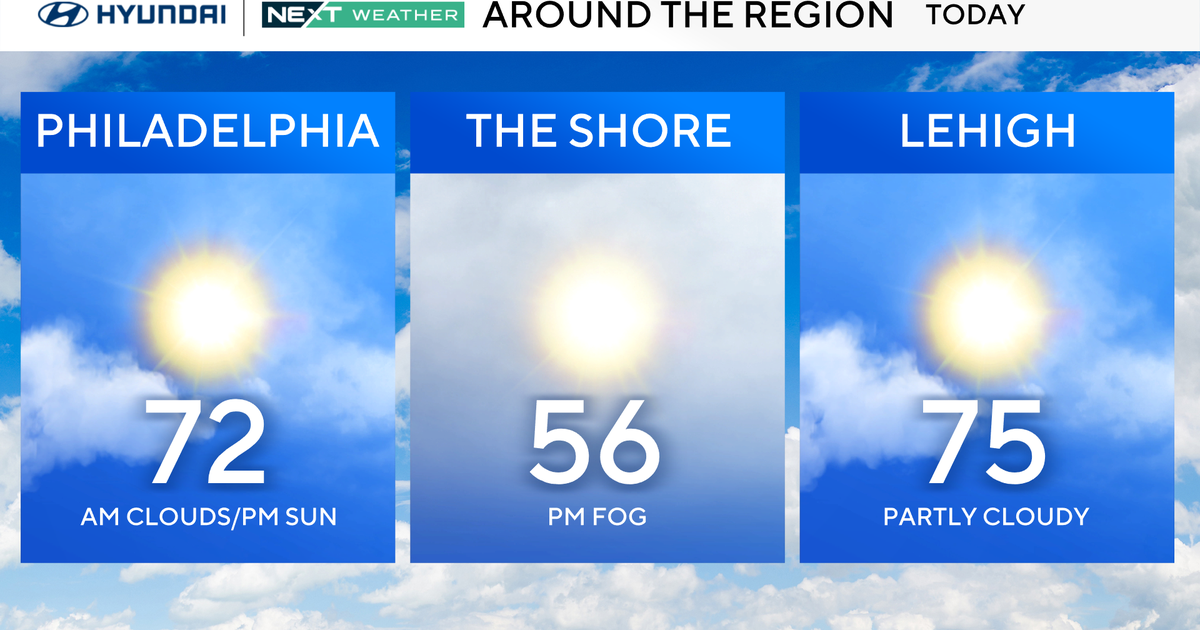
On Saturday morning, we'll likely start with a little sunshine before the clouds thicken up ahead of a weather maker that may impact your Saturday evening between 5 p.m. and 11 p.m.
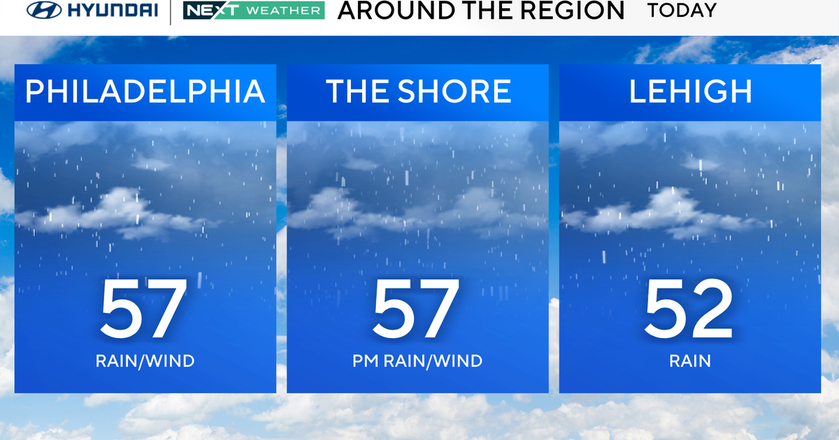
While there will be showers Saturday and the possibility of lightning/thunder, nothing is expected in the way of heavy rain or severe weather.
We'll start to see a stray sprinkle around 3 p.m. or 4 p.m. Then later on, if you're heading out around 8 p.m. to 10 p.m., you'll want to keep your umbrella handy.
After this rain a cold front takes over for Sunday, bringing another considerable change in the form of wind and colder temperatures.
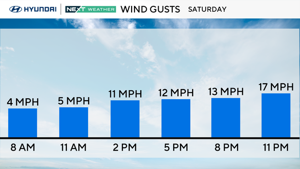
Sunday will start off mild thanks to the cloud cover Saturday night, but temperatures will peak early before falling during the day with gusty NW winds, which may affect your Eagles tailgating festivities. By kickoff time, the temperature will in the mid-low 40s with feels like temps in the 30s so be sure to have the layers if headed to the Linc as winds will be gusting to 30 mph.
Once again, Monday will be a breezy and chilly day with highs only in the 40s and winds gusting to 30mph. Not quite as windy and cold as this past Tuesday but noticeable for sure. Another chance of showers by Tuesday night. Stay warm!
Here's your 7-day forecast:
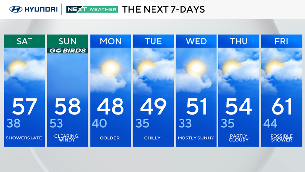
Saturday: Showers late. High 57, Low 38.
Sunday: Clearing, windy. High 58, Low 53.
Monday: Colder. High 48, Low 40.
Tuesday: Chilly. High 49, Low 35.
Wednesday: Mostly sunny. High 51. Low 33.
Thursday: Partly cloudy. High 54, Low 35.
Friday: Possible shower. High 61, Low 44.