Warm, mostly dry Saturday ahead of rainy Easter Sunday in Philadelphia area. Here's the weather forecast.
Saturday is the better day to get outside this weekend, as the chance for rain is fairly low in the Philadelphia area. Not zero, but a few passing showers Saturday night are about all we expect.
During the day we'll have mostly sunny to partly cloudy skies and highs near or at record territory, with many areas in the 70s and 80s by the early afternoon, before a back-door cold front moves in.
The front brings increasing clouds and those shower chances we mentioned.
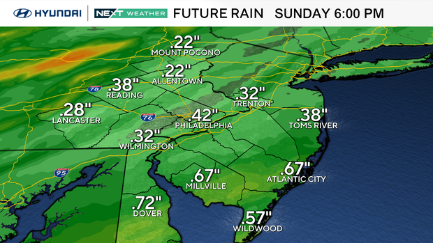
Have your umbrella ready on Easter, as a cold front will move through the area bringing widespread showers to the region.
NEXT big weather changes
The rollercoaster ride continues with another surge of warmth that will bring temps back to near or slight above record-breaking temps in the low 80s early this afternoon.
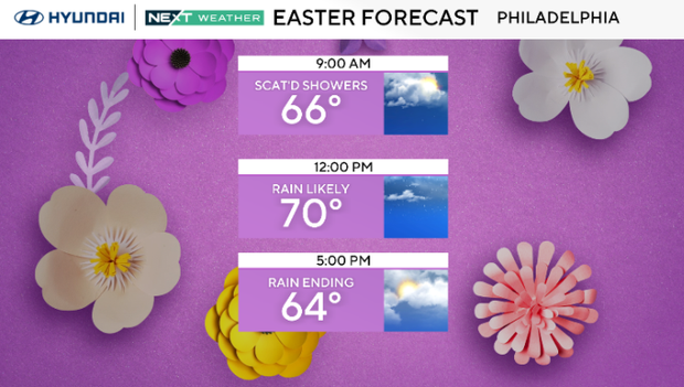
By Easter Sunday, another cold front will approach the region with a line of showers and storms development ahead of it. Right now, it looks like conditions may start out dry Sunday morning with rain arriving by midday.
The rain will start to clear out Sunday evening as the front moves through and begins to usher in drier, but cooler temperatures for next week.
Next week we'll be back to more normal highs for this time of year which is upper 50s. It'll be quieter as well, with mostly sunny to partly cloudy skies.
Although you may be tempted to start planting this weekend, you may want to hold off as freezing temps are expected by the middle of next week.
While the average last freeze is March 30, Philadelphia has had a freezing temp as late as May 11.
Here's your 7-day forecast:
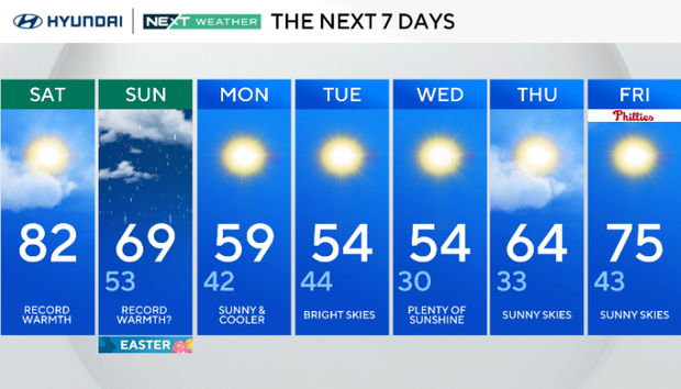
Saturday: Record warmth? High 82, low 61.
Sunday: Rain Easter. High 68, low 53.
Monday: Breezy and cooler. High 59, low 44.
Tuesday: Partly cloudy. High 54, low 43.
Wednesday: Sunny skies. High 54, low 32.
Thursday: Partly cloudy. High 64, low 38.
Friday: Warming up. High 75, low 49.