Summer-like heat, humidity in Philadelphia area Friday; cooler for the weekend. Here's the weather forecast.
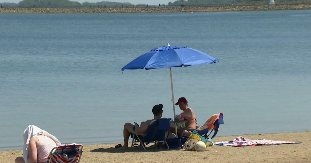
Summer weather is back! At least for your Friday in the Philadelphia area, as high temps will be pushing 90 degrees, yes, 90 in mid-September. The record high is 92, so we're not thinking that, but we will be much closer to the record high than the normal.
As for this final weekend of summer, it will be more fall-like than summer-like. Temperatures will hover near average in the upper 70s on Saturday and dip to the mid-70s on Sunday.
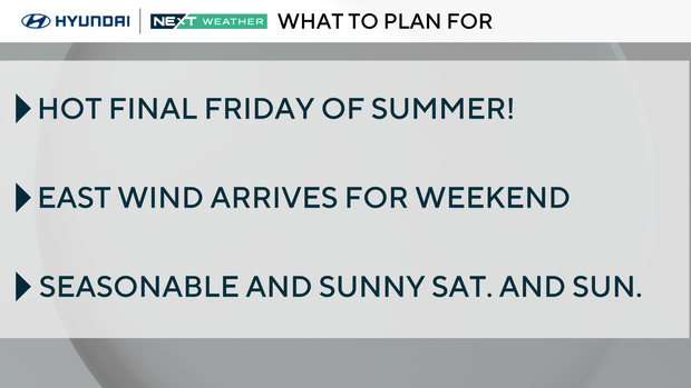
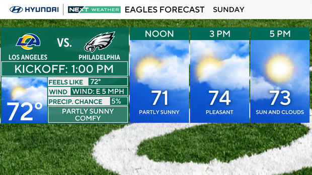
Expect plenty of sunshine on Saturday and partly sunny skies on Sunday. Perfect weather for our perfect Eagles as they host the Rams for a 1 p.m. kickoff.
You'll want to have the cable knit sweater, boots and pumpkin spice lattes ready by Monday because Fall officially arrives at 2:19 p.m. It will be sunny with near-average temperatures in the upper 70s to low 80s. Perhaps make it a lightweight sweater.
Summer tries to sneak back in Tuesday, the first full day of fall. Highs will reach the low 80s with partly sunny skies and a chance of scattered showers later in the day. We need rain, but not all of us will receive enough rain or even see a shower Tuesday, so be prepared to water any fall plants.
The dry stretch rolls on through the end of the week with highs in the mid to upper 70s.
For all you leaf peepers, the fall foliage in southeastern Pennsylvania, New Jersey and Delaware is still low to no color.
Give it another week, and by early October, the leaves should be changing in the Poconos. Several weeks after that, the Lehigh Valley and areas west of the city will begin changing. In late October, the vibrant colors will pop up around the city.
Tracking the Tropics
Gabrielle remains a tropical storm with winds sustained at 50 mph, moving northwest at 14 mph. The storm is still about 700 miles away from the northern Leeward Islands, so no land is threatened anytime soon. The forecast track is similar to Erin but bears watching next week as Gabrielle is forecast to become a hurricane by Sunday.
There is also an additional area of interest much farther east that has a 20% of developing into a named storm over the next seven days. That storm would be named Humberto.
Here's your 7-day forecast:
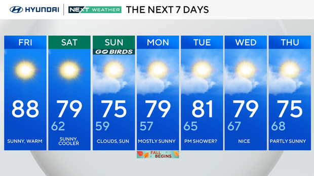
Friday: Sunny, warm. High 88, Low 62.
Saturday: Sunny, cooler. High 79, Low 62.
Sunday: Clouds, sun. High 75, Low 59.
Monday: Mostly sunny. High 79, Low 57.
Tuesday: P.M. shower? High 81, Low 65.
Wednesday: Nice. High 79, Low 67.
Thursday: Partly sunny. High 75, Low 68.