Beautiful Monday across Philadelphia region before NEXT round of storms arrive Tuesday. Here's the weather.
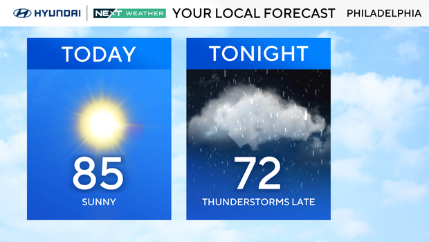
Monday brings another beautiful summer day across the Delaware Valley. Expect plenty of sunshine, seasonable temperatures in the mid-80s and relatively comfortable humidity through much of the day.
It will be a great day for outdoor plans, although clouds will begin to increase late as our NEXT weather maker approaches from the west. Most locations stay dry through the daylight hours.
NEXT big change to bring severe weather
A much more active weather pattern arrives Tuesday as a cold front moves into the region. Scattered showers and thunderstorms are expected to develop, with the strongest storms likely during the afternoon and evening.
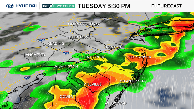
Some storms could become severe, producing damaging wind gusts, torrential downpours, frequent lightning, hail and an isolated tornado.
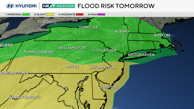
Be prepared for changing weather conditions and possible travel delays Tuesday afternoon and night.
Behind the front, conditions gradually improve later Wednesday into the latter half of the work week with lower humidity returning.
Here's your 7-day forecast:
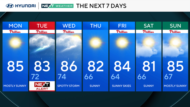
Monday: Mostly sunny, warm and pleasant. High 85
Tuesday: NEXT Weather Alert. Spotty AM showers/storms, then severe storms likely late. High 82.
Wednesday: Spotty storm. High 86, low 74.
Thursday: Sunny. High 82, low 66.
Friday: Sunny. High 84, low 64.
Saturday: Sunny. High 81, low 66.
Sunday: Mostly sunny. High 85, low 67.


