Sweat meter returns to moderately high Thursday in Philadelphia region. Here's the weather forecast.
Humidity is coming back up in the Philadelphia region, but after some morning cloud cover, it's a mostly sunny day with another high temperature near 90 degrees.
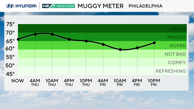
The sweat meter returns to moderately high today, with dew points back in the 70s. You'll definitely notice the increase in moisture if you're working outside or exercising outdoors today. That said, it's an overall tranquil August day with sunshine and dry conditions.
NEXT big weather changes
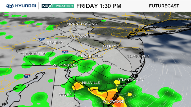
Friday, a front makes some southward progress through the region, allowing drier air to push in behind it. There may be a few showers along that frontal boundary, mainly south of Philadelphia, in the afternoon.
Humidity will begin to drop late Friday into Friday night, so things look nice for any outdoor dinner plans.
Saturday looks like the pick of the week with sunshine and comfortable humidity.
Then, our NEXT Weather maker approaches with the chance for showers and storms on Sunday.
Right now, it appears the second half of the day will have more storm activity, but a few showers may be around earlier as well.
Another half-and-half weekend! Shower and storm chances may linger into Monday, with drier air likely arriving again Tuesday.
Here's your 7-day forecast:
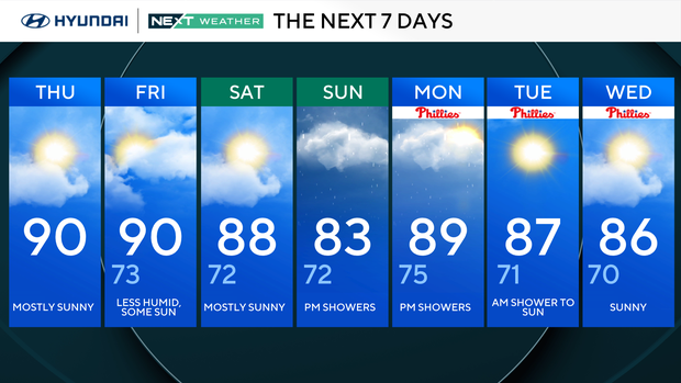
Thursday: Clouds to sun. High 90
Friday: Isolated showers. High 90, Low 73
Saturday: Sunny. High 88, Low 72
Sunday: PM showers. High 83, Low 72
Monday: AM showers to sun. High 89, Low 75
Tuesday: Sunny. High 87, Low 71
Wednesday: Mostly sunny. High 86, Low 70
Get the latest weather info on the CBS News Philadelphia app.


