Clouds increase Friday in Philadelphia region, light snow possible Saturday morning
Today will be less windy, but there will still be a breeze and gusts up to 25 mph. Temperatures in the upper 30s will feel like 30, so there will be at least some improvement.
If that doesn't sound like something to get excited about, remember we had feels-like temperatures in the single digits overnight earlier this week. As our next system approaches, clouds will increase in the Philadelphia region by late Friday.
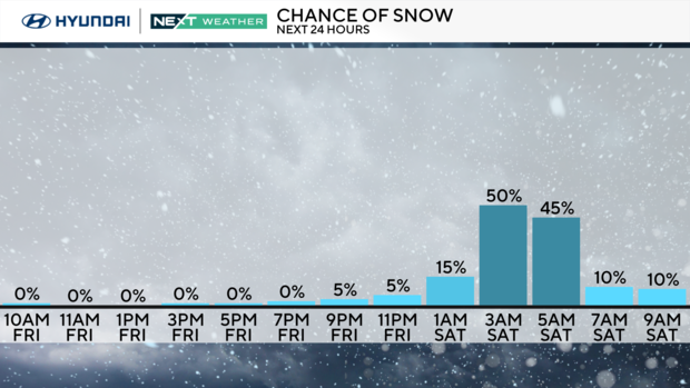
Looking ahead to the Saturday snow chance, it's less likely that snow lovers will get a big dumping of snow out of this one. That said, we may get at least some light snow.
The latest model trends keep most of the storms to our south, with intensification happening too late for a major storm to occur over our area.
So what does that mean for us?
Saturday morning will bring light snow or snow showers, which can accumulate easily on cold ground. Currently, it looks like a half-inch coating, with possibly a bit more in spots to the south, but it doesn't look anything significant.
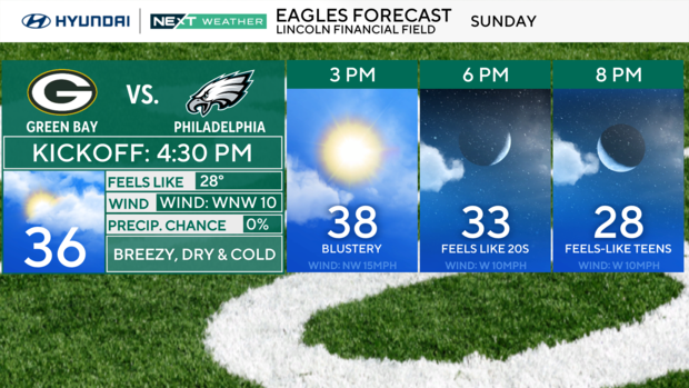
It's looking chilly but dry for the Eagles-Packers NFL playoff game at Lincoln Financial Field on Sunday, with a high near 40 degrees.
Next week, we will briefly warm into the 40s by Monday before heading back below freezing for a few days beginning Tuesday.
Here's your 7-day forecast:
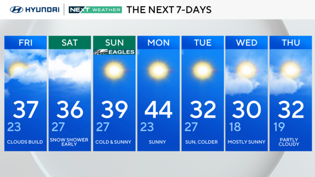
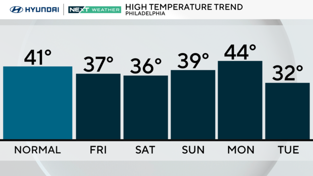
Friday: Clouds build. High 37, Low 23
Saturday: Snow shower early. High 36, Low 27
Sunday: Cold and sunny for Birds-Packers. High 39, Low 27
Monday: Sunny. High 44, Low 23
Tuesday: Sun, cooler. High 32, Low 27
Wednesday: Mostly sunny. High 30, Low 18
Thursday: Partly cloudy. High 32, Low 19