Bitter cold weather continues in Philadelphia, tracking a milder weekend

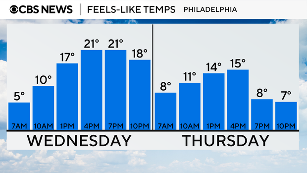
Wednesday will continue our bitter stretch of cold weather. Our morning low of 17 made this morning the coldest of February so far, and wind chills have been in the single digits.
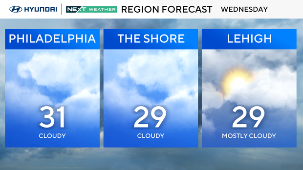
The winds will die down a bit today, but even a light northwest breeze will keep the chills in the teens and low 20s all day.
The Philadelphia region is in the midst of the coldest winter since 2014-15, with an average temperature of 34.6 degrees from Dec. 1, 2024, to Feb. 18, 2025.
We'll stay dry with increasing clouds but will watch closely a major weather system bringing snow to millions of people across the Midwest and mid-Atlantic, but in our area, it looks to be a dud.
The outer reaches may get as far north as Cape May, but we are talking little to no accumulation over a large majority of our area by Thursday evening. Because of this, the NEXT Weather Team has removed the weather alert for Thursday. It will be very cold and breezy, but commutes and schools will operate as normal. There was a time when the models had a major snowmaker here, but that is not going to materialize.
For now, Friday and Saturday look sunny, dry, and cool. If you have any plans, it's not too bad.
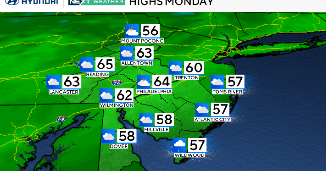
Sunday is trending dry and slightly warmer. We may be near 50 on Sunday and Monday.
Here's the 7-day forecast:
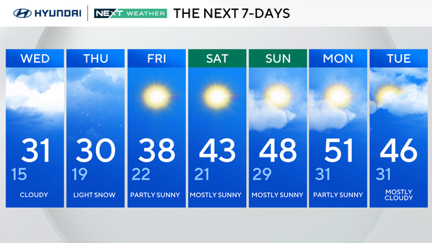
Wednesday: Cloudy. High 31, low 15.
Thursday: Light snow. High 30, low 19.
Friday: Partly sunny. High 38, low 22.
Saturday: Mostly sunny. High 43, low 21.
Sunday: Mostly sunny. High 48, low 29.
Monday: Mostly sunny. High 51, low 31.
Tuesday: Mostly cloudy. High 46, low 31.
Get the latest weather info on the CBS News Philadelphia app.