An unsettled weather week ahead for Philadelphia area | NEXT Weather forecast

Did you soak up the sun the past few days? Hopefully, the answer is yes, because we're about to enter an extended period of rain, fog, a few storms, and cloudiness that could last through at least the first half of the weekend in the Philadelphia area.
Tuesday will feel muggy, sitting in the 50s to low 60s, with patchy fog likely in time for the early part of the morning commute.
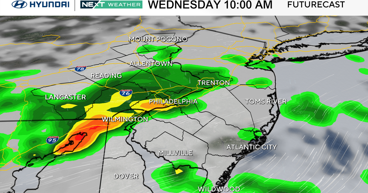
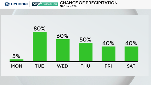
The region will see periods of light rain and scattered showers all day, with some heavier rain and an isolated storm this evening into tonight. The rain will continue into Wednesday morning before tapering off a bit.
Rain returns Tuesday into Wednesday
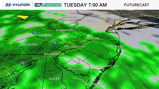
Get ready for widespread showers, with the heaviest rain and even a few isolated thunderstorms possible Tuesday night, particularly across South Jersey. If you're heading to the Phillies game Tuesday night against the St. Louis Cardinals, keep an eye on the forecast. There could be delays or even a postponement in the cards.
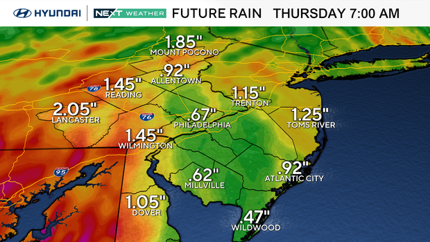
Wednesday keeps the rainy pattern going, and while we can't rule out a few rumbles of thunder, things should start to quiet down a bit by Wednesday night. Rainfall totals from late Monday through Wednesday could reach:
- 1 to 1.5 inches across most of the region
- 1.5 to over 2 inches for Delaware and parts of South Jersey
The flood risk is low, but southeastern Pennsylvania and Delmarva are under a Marginal Risk (level 1 out of 4) for excessive rainfall for Tuesday into the night.
Thursday brings a brief break before storm chances ramp up
Thursday offers a bit of a break in the action. While some isolated showers may linger early, expect mainly dry conditions for much of the day. Highs will be pleasant in the 70s, with lows staying mild in the 60s.
But don't put the umbrella away just yet — more rain and thunderstorms return late Friday into the weekend.
A series of cold fronts moving through Friday and Saturday will bring increased chances for showers and storms, some of which could be stronger due to a bit more instability. Temperatures will be warmer as well.
Right now, there's no NEXT Weather Alert, but we're watching it closely, especially as the Friday and Saturday systems evolve.
Weekend outlook: Keep the rain gear handy
Saturday looks like Friday with another front sweeping through, keeping the threat of storms in play. By Sunday, the pattern begins to quiet down slightly, but there's still a chance for a few lingering showers to close out the weekend.
Stay tuned as we track those late-week fronts for any signs of severe weather.
Here's your 7-day forecast:
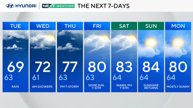
Tuesday: Rain. High of 69, low of 63.
Wednesday: Morning showers. High of 72, low of 61.
Thursday: P.m. thunderstorm. High of 77, low of 63.
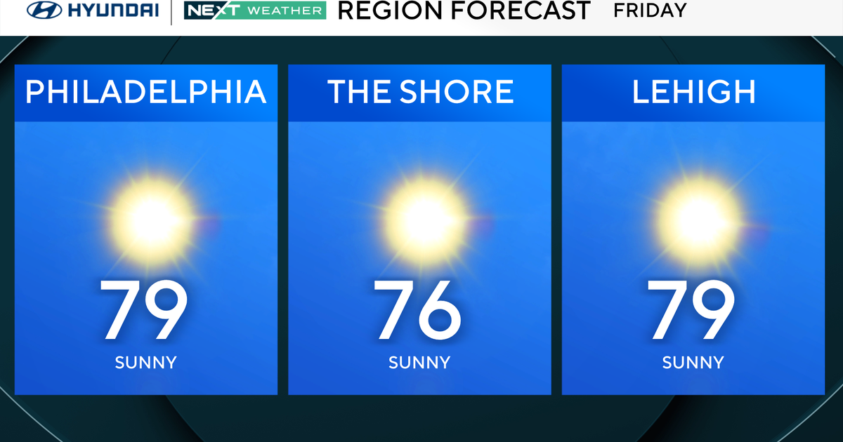
Friday: Some sun, thunderstorm. High of 80, low of 63.
Saturday: A few showers. High of 83, low of 64.
Sunday: Sunshine. High of 84, low of 64.
Monday: Mostly sunny. High of 80, low of 64.
Get the latest weather info on the CBS News Philadelphia app