Rain precedes an Arctic blast Wednesday in Philadelphia region. Here's the weather forecast.

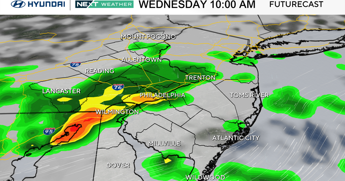
Expect increasing and thickening clouds Wednesday ahead of a truly game-changing cold front. Highs will be in the 50s, and there is some light rain ongoing early across the Lehigh Valley and Poconos.
Later this evening, spotty showers develop near the city, but the frontal passage doesn't occur until after midnight with a band of rain showers — possibly ending in spots as a brief mix with snow.
It's looking less likely that we'll see much snow with this front, except possibly a brief mix on the back end of the front around 3 a.m.
NEXT big weather change
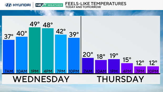
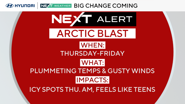
Precipitation will be over by the time the Thursday morning commute gets underway, but temperatures will rapidly fall below freezing, meaning we could see some icy spots, especially in areas northwest of Philadelphia.
Behind the cold front, some sun will return for the end of the week, but bitterly cold temperatures pour in. Highs both Thursday and Friday will be in the 30s; barely above freezing in many spots, with a gusty wind making temperatures feel like the single digits and teens by Friday morning.
Because of this, a NEXT Weather Alert has been issued for both days due to this Arctic blast.
A second reinforcing cold shot arrives Sunday, and a third next Tuesday, Jan. 20, will bring the coldest air of the season so far — only in the 20s for highs Tuesday with morning wind chills likely near zero in many spots.
We've gone ahead and issued a NEXT Weather Alert for Tuesday because of this extreme cold.
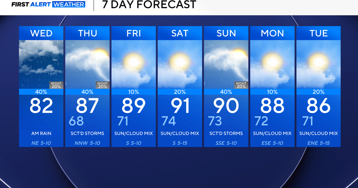
Here's your 7-day forecast:
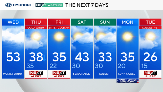
Wednesday: Rain/snow at night. High 53, low 40.
Thursday: NEXT Weather Alert, cold and windy. High 38, low 35.
Friday: NEXT Weather Alert, bitter start. High 35, low 22.
Saturday: Seasonable. High 43, low 30.
Sunday: Cold again. High 33, low 30.
Monday/MLK Day: Bitter cold. High 35, low 20.
Tuesday: NEXT Weather Alert for the coldest weather of the season. Very cold. High 26, low 15.